DDiscover AloneMapAbout

Hillfort in Clopook

Hillfort

The monument record does not grant public access. Check the route and ask the landowner before entering private land.

What survives
Recorded monument
What do you know about this place?Tap to add a comment or ask a question

What you write will be public.

What is recorded here

The placename ‘Cloghpooke’ is annotated on the 1563 map of Laois-Offaly and this hilltop fortress or hillfort is traditionally associated with the O’Moore/O'More clan. Clopook was located in the Gaelic lordship of 'Farryn O'Kalle' and in 1551 the lands of 'Powkiscastell' [Clopook] were leased to Sir John Travers…

Read the whole record
The placename ‘Cloghpooke’ is annotated on the 1563 map of Laois-Offaly and this hilltop fortress or hillfort is traditionally associated with the O’Moore/O'More clan. Clopook was located in the Gaelic lordship of 'Farryn O'Kalle' and in 1551 the lands of 'Powkiscastell' [Clopook] were leased to Sir John Travers (Nicholls 1994, 166). In 1569 the lands of 'Cloghpowke' [Clopook] were leased by the Crown to Francis Cosbie [Cosby] (ibid, 175-6). In 1593 the Crown leased the lands of 'Cloghpowle' [Clopook] to Alex Cosbie of Stradbally (ibid., 221). The name 'Powkiscastell' now Cloghpook can be interpreted as the stone or stone fortress of the pooka (Joyce 1871, 183). Impressive remains of a large polygonal-shaped enclosure (int. dims. c. 105m N-S; 115m E-W) known as the ‘Dun of Clopook’ situated on top of high rock outcrop similar to the Rock of Dunamase with commanding views of the surrounding countryside in all directions. Standing stone (LA019-025001-) 765m to the E, the Dun of Luggacurren (LA025-005001-) 875m to the S, church (LA019-022----) and graveyard (LA019-022001-) located 275m to the SW. Small circular pond of unknown antiquity located at base of slope 194m to the SSW. The hillfort is today situated in an area of woodland and the interior of the monument is impossible to examine due to the dense cover of vegetation covering the interior of the monument. Depicted on the 1906 25-inch OS map as a large hilltop enclosure or hillfort with causewayed entrance gap across rock-cut fosse at W. A second possible entrance gap is indicated at E with small rectangular building standing in this entrance gap. A small square-shaped building similar to a tower house (LA019-021004-) is depicted standing in the SE quadrant of the hillfort interior. Immediately to the E of this entrance gap there is a small outer bank with entrance gap acting like a barbican or defensive earthwork protecting the entrance into the hillfort interior. Neither of these buildings are depicted on the 1838 ed. OS 6-inch map. A cave (LA019-021002-) is depicted cut into the SW face of the rock outcrop on which the hillfort is situated. This cave is located below the hillfort cut into the SW face of the rock outcrop and is depicted on the 1838 ed. OS 6-inch map. A trig. station marking the OD level as 612 ft. [186m] above sea level is depicted in the N quadrant of the hillfort on the 1838 ed. OS 6-inch map. Present remains consist of a circular area (diam. c. 100m) defined by a bank (Wth c. 7m, int. H c. 1.75m) constructed of earth and stone, except at E where it is defined by a stone wall (Wth c. 6m, H c. 1m). Modern ramp at E. No evidence of fosse. Reference to a hut site (LA019-021003-) here (Walsh 1972, 17), and a possible castle site (LA019-021004-) (O'Hanlon and O'Leary 1907, 243). Described by Daniel Byrne in 1852 as ‘the dun of Cloch-an-Phuca, commonly called Clopook, i.e. the Puca’s Rock, is situated in a valley about two miles, in a southerly direction from Timahoe, in the Queen’s County. It consists of a partially isolated rock, standing out from the range of hills on the northeast side of the valley, and was mot probably at a very early age occupied as one of the chief fortresses of the O’Moore’s, perhaps indeed a royal residence. The diameter of the dun at the summit, from north-east to south-west is nearly the same. Around the top are the remains of a stone and lime cemented fortification about 12 feet [3.65m] in breadth. Within this circle on the south-east are the foundations of two chambers or a castle divided into two apartments; the principal apartment is fifteen feet [4.5m] by fourteen [4.25m]. This castle stood near the verge of the dun, and was composed of stone, with lime and sand cement. The height of the dun from the surface of the land on the north and east is more than one hundred and forty feet [42m] and it is of equal height on the south-west. Within the rock, and beneath the fortification above described, is an extensive cave the entrance of which is on the south-west side. It is seven yards [6.4m] in breadth and three [2.7m] in height; as a person advances in, it is from four [3.65m] to five [4.5m] yards in breadth and at thirteen yards [11.8m] from the entrance it becomes extremely narrow, and is closed up by dry stones, lest cattle descend into the cave and be lost’(Byrne 1852, 298). Comerford recorded that the ‘Dun of Clopoke, about five miles from Dunamase (LA013-052----), is a curious object; it is a conical hill of limestone, its diameter on the summit is 312 feet [95m], and round it ran a wall. Its base was defended by a double entrenchment; from the base to the top it measures in some places 150 feet [45.7m], being very precipitous and strong on every side. Under the N.E. side of the hill is a cave (LA019-021002-)’ (Comerford 1886, 129). This monument was described in the History of Queen’s County, ‘as the famous Dun or Doon of Clopoke. This stood on an isolated rock, and apparently its sides were scarped, to render it nearly circular on the top. There, the diameter is said to be nearly 110 yards [100m]; and that surface is now nearly level. However, around the edges are the remains of a circumvallation, built with stone and lime cement. It is stated, that near the verge of the circle stood a castle (LA019-021004-) in former times, and that at its foundations were two compartments; the principal chamber being 15ft. [4.5m] by 14ft. [4.2m]. The name in Irish is said to have been Dun-Cluain-Phuc, interpreted as “the fortress of the lonely spirit’. Tradition has it, that the Dun, which is ascended by a series of irregular steps, was once a strong fortress of the O’Moore’s’ (O’Hanlon and O’Leary 1907, 342). The hillfort was recently described in the Atlas of Hillforts of Britain and Ireland as following; 'Possible multiple enclosure situated on top of prominent rock outcrop with panoramic views from the summit. The site has a total footprint of approximately 3.4ha. There is a simple entrance gap at the W and an E entrance with outworks. Possible hut structure within interior recorded by Walsh (1972, 17). Possible high Medieval tower house within interior near E entrance. Inner enclosing elements taking 0.86ha survive well throughout its circuit. Possible outer enclosing elements were identified by Grogan (2005b, 114) and have not been confirmed as being related to the hillfort. Interior is heavily overgrown and under dense tree cover. Earliest written reference by Byrne (1852). Detailed earthwork survey in second edition Ordnance Survey maps. Monument survey by Sweetman et al. (1995, 17).'(http://hillforts.arch.ox.ac.uk/records/IR0739.html) See attached Bing Maps aerial photograph taken between 06-07 November 2011 which shows growth of vegetation on the hillfort. Compiled and revised by: Caimin O'Brien Date of revised upload: 6 February 2020

From the National Monuments Service (Archaeological Survey of Ireland) record LA019-021001

Places near here

Picture notes
  • Computer-made picture. It does not show this monument.
  • National Inventory of Architectural Heritage
  • Computer-made picture. It does not show this mountain top.
  • A.-K. D., Wikimedia Commons · CC BY-SA 4.0
  • Computer-made picture. It does not show this garden.
  • Graham Horn, Geograph · CC BY-SA 2.0
Hut site in ClopookHut site · 17 ydTom: I’m here to help · Computer-made picture. It does not show this monument.

Explorer Tom Hut site in Clopook has caught my eye in Clopook, County Laois. I bet a hut site with a name like that could keep me talking all afternoon; I'm already inventing a daft little scene for it, and I'll stop before it turns into history.

ExcavationExcavation, miscellaneous · 43 ydTom: I’m here to help · Computer-made picture. It does not show this monument.

Explorer Tom Excavation has caught my eye in Clopook, County Laois. I bet a excavation, miscellaneous with a name like that could keep me talking all afternoon; I'm already inventing a daft little scene for it, and I'll stop before it turns into history.
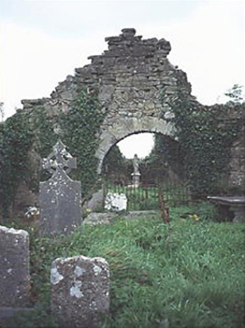
graveyard/cemetery373 yd

Explorer Tom Graveyard or cemetery in Clopook has caught my eye in Clopook, County Laois. I bet a graveyard/cemetery with a name like that could keep me talking all afternoon; I'm already inventing a daft little scene for it, and I'll stop before it turns into history.
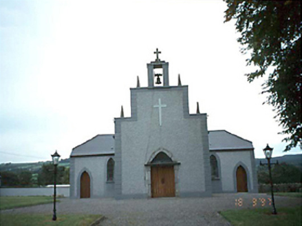
Catholic Church of the Holy RosaryChurch/chapel · 1.2 mi

Explorer Tom Catholic Church of the Holy Rosary has caught my eye in Luggacurren, County Laois. I bet a church/chapel with a name like that could keep me talking all afternoon; I'm already inventing a daft little scene for it, and I'll stop before it turns into history.

Fossy MountainMountain / peak · 2.1 miTom: I’m here to help · Computer-made picture. It does not show this mountain top.

Explorer Tom Fossy Mountain has caught my eye in County Laois. I bet a mountain / peak with a name like that could keep me talking all afternoon; I'm already inventing a daft little scene for it, and I'll stop before it turns into history.

Dm PenderMemorial · 2.3 mi

Explorer Tom Dm Pender has caught my eye in County Laois. I bet a memorial with a name like that could keep me talking all afternoon; I'm already inventing a daft little scene for it, and I'll stop before it turns into history.

Ballintubbert Gardens and HouseGarden · 2.4 miTom: I’m here to help · Computer-made picture. It does not show this garden.

Explorer Tom Ballintubbert Gardens and House has caught my eye in County Laois. I bet a garden with a name like that could keep me talking all afternoon; I'm already inventing a daft little scene for it, and I'll stop before it turns into history.

Carrig HillMountain / peak · 2.6 miTom: I’m here to help · Computer-made picture. It does not show this mountain top.

Explorer Tom Carrig Hill has caught my eye in County Laois. I bet a mountain / peak with a name like that could keep me talking all afternoon; I'm already inventing a daft little scene for it, and I'll stop before it turns into history.

Oughaval Wood MapVisitor information · 2.8 mi

Explorer Tom Oughaval Wood Map has caught my eye in County Laois. I bet a visitor information with a name like that could keep me talking all afternoon; I'm already inventing a daft little scene for it, and I'll stop before it turns into history.

Ballyadams Castle (in Ruins)Castle, tower house · 2.8 mi

Explorer Tom Ballyadams Castle has caught my eye in Ballyadams, County Laois. I bet a castle, tower house with a name like that could keep me talking all afternoon; I'm already inventing a daft little scene for it, and I'll stop before it turns into history.

Ballyadams CastleCastle · 2.8 mi

Explorer Tom Ballyadams Castle has caught my eye in County Laois. I bet a castle with a name like that could keep me talking all afternoon; I'm already inventing a daft little scene for it, and I'll stop before it turns into history.

CemeteryGraveyard · 3.0 mi

Explorer Tom Cemetery has caught my eye in Carricksallagh, County Laois. I bet a graveyard with a name like that could keep me talking all afternoon; I'm already inventing a daft little scene for it, and I'll stop before it turns into history.

More archaeology and monuments in County Laois · All of County Laois

Add to this placeAdd a picture Add a detailed tip Add a story

Explore the map1,087,615 places to discover

Next place · or swipeHut site in Clopook