
Places near here
Photo credits
- National Inventory of Architectural Heritage
- Liam, Geograph · CC BY-SA 2.0
- Garry Dickinson, Wikimedia Commons · CC BY-SA 2.0
- Sitomon, Wikimedia Commons · CC BY-SA 2.0
- EecherplazGinkgo06.jpg : Cayambe derivative work: Ginkgotree ( talk ), Wikimedia Commons · CC BY-SA 3.0
- Jon Sullivan, Wikimedia Commons · Public domain
- Joseph Mischyshyn, Geograph · Creative Commons Attribution-ShareAlike 2.0
- Colin Park, Wikimedia Commons · CC BY-SA 2.0
- Greg and Cindy, Wikimedia Commons · CC BY 2.0
- Colin Park, Geograph · CC BY-SA 2.0
- No machine-readable author provided. Christian1965~commonswiki assumed (based on copyright claims)., Wikimedia Commons · Public domain
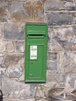 post box351 yd
Explorer Tom Post box in Cloghatacka was saved by a hero nobody remembers, who probably just threw a bag of cement at a falling tree and ran away without asking for a medal. It still stands there, solid as a rock, collecting letters like it’s hoarding treasure for a future retirement on a tropical island. Give it a respectful nod.
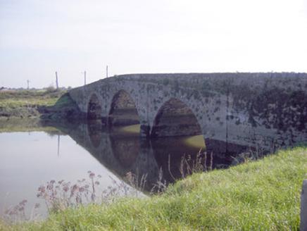 Ferry BridgeBridge · 463 yd
Explorer Tom Ferry Bridge in Cloghatacka nearly became famous when the tides messed up the original arches, which is basically its entire personality right there. A guy finished it later because he had nothing better to do with his life, apparently. Stand on it for a moment and appreciate the masonry skills of your ancestors.
 Court Castle (in ruins)Castle, tower house · 1303 yd
Explorer Tom Court Castle in Court is standing right by the river, and I bet a cow once tried to buy it for a bucket of oats. It’s low, square, and looks like it’s waiting for someone to ask it out to dinner. Stand on the spot and imagine the gossip it's heard.
_-_geograph.org.uk_-_6570180.jpg/250px-Castles_of_Munster,_Court,_Limerick_(1)_-_geograph.org.uk_-_6570180.jpg "Photo: Garry Dickinson, Wikimedia Commons · CC BY-SA 2.0") Court CastleCastle · 1303 yd
Court CastleCastle · 1303 ydExplorer Tom Court Castle in County Limerick has very strong opinions about Dublin tourists who think they can just wander up without checking their phone for directions first. It watches them fumble around the perimeter, judging their lack of local charm and poor fashion choices from its stone height. Have a wander and a wonder.
 European Yew4.0 mi
Explorer Tom European Yew in County Limerick has been standing around so long the Vikings got lost looking for it. They probably missed it because they were too busy arguing about compass bearings. Count the crows, then count again.
 Ginkgo4.1 mi
Explorer Tom Ginkgo in County Limerick is secretly proud of a potato it planted in 1952 that never sprouted. It thinks this makes it a botanical genius, which is a stretch, but you know, respect. A good place to forget your phone for ten minutes.
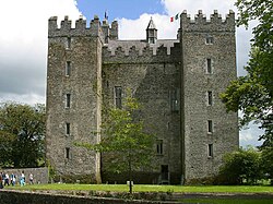 Bunratty CastleCastle/fortified house · 5.8 mi
Explorer Tom The local sheep at Bunratty Castle have strong opinions about the tourists, mostly that they walk too slow and block up their grazing routes effectively every single day of the week. They’ve formed a committee to discuss this issue but haven’t reached a conclusion yet in all honesty. Go with someone who loves old stuff and watch them melt.
 Graveyard5.9 mi
Explorer Tom Graveyard in Bunratty West is hanging out right behind the castle hotel, which feels like standing in someone's kitchen. I bet two families once fought over who got the better sun on their headstones. Look up, because the best gossip is always above your eye level.
 Bunratty Folk ParkTheme or amusement park · 6.0 mi
Explorer Tom Bunratty Folk Park hosted a fake royal visit that nobody can disprove because everyone was too busy eating pastries. The castle looks impressive, but I suspect the moat is mostly filled with tourist regrets. Have a sandwich here and call it a heritage lunch.
 Pan Am Flight 1-10Aviation accident · 8.9 mi
Explorer Tom Pan Am Flight 1-10 hit the ground hard enough to make the builders rethink their entire career choices. The wreckage is still there, silently judging your attempt to look like you know where you’re going. Stand still and listen, the wind tells it better than me.
 KnockfeerinaMountain / peak · 10 mi
Explorer Tom Knockfeerina thinks the road leading to it is too fancy for a humble peak, so it pretends not to be there. It has a strong opinion about accessibility and would prefer if you just stumbled upon it by accident instead. Ten minutes here and you'll have a yarn for the pub.
 Áine and Gearóid Iarla: Lough GurLegend location · 12 mi
Explorer Tom Áine and Gearóid Iarla: Lough Gur has a goddess for the lake and a sleeping lord in the old stories. I thought I was coming to admire water and stones. Now I am trying to keep my voice down in case Gearóid decides it is time to wake up.
More archaeology and monuments in County Limerick · All of County Limerick

What do you know about this place?Tap to add a comment or ask a question