What is recorded here
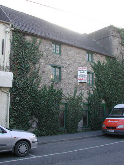
Outbuilding in Thomastown went from storing goods to accommodating people, and now the ivy is moving in. Three storeys beside a castle, nobody home to argue, one tendril through the window and it’ll be calling itself landed gentry.
Attached two-bay three-storey outbuilding, c.1700. Refenestrated, c.1850. In use as warehouse, pre-1973. Renovated, post-1973, with openings to ground floor remodelled to accommodate residential use. Now disused. Pitched slate roof with clay ridge tiles, and cast-iron rainwater goods on squared rubble stone eaves. Part ivy-clad random rubble stone walls (originally rendered with render removed, post-1973). Square-headed window openings (remodelled to ground floor, post-1973) with no sills, timber lintels, and replacement timber casement windows, c.1850, to upper floors having replacement timber casement windows, post-1973, to ground floor. Square-headed door opening with cut-limestone step, timber lintel having squared rubble stone voussoirs over forming segmental relieving arch, and replacement glazed timber panelled double doors, post-1973. Road fronted with concrete flagged footpath to front.
An appealing rubble stone range of rustic appearance probably originally having associations with the adjacent Brady's Castle (12317072/KK-28-17-72) serving either as an agricultural outbuilding or possibly as an early industrial site. Despite some modifications to accommodate an alternative purpose much of the early character survives intact, thereby contributing positively to the historic quality of the street scene.
From the Buildings of Ireland (National Inventory of Architectural Heritage) record 12317073
This does not grant access. Most recorded buildings are privately owned; view them only from public ground unless the owner allows entry.
Places near here
Photo credits
- Mike Searle, Geograph · CC BY-SA 2.0
- A.-K. D., Wikimedia Commons · CC BY-SA 4.0
- National Inventory of Architectural Heritage
- A.-K. D., Wikimedia Commons · CC0
- Gerd Eichmann, Wikimedia Commons · CC BY-SA 4.0
- Andreas F. Borchert, Wikimedia Commons · CC BY-SA 4.0
- Kieran Campbell, Wikimedia Commons · CC BY-SA 2.0
- Stephan van Helden, Wikimedia Commons · CC BY-SA 4.0
- Algirdas at Lithuanian Wikipedia, Wikimedia Commons · Public domain
 castle/fortified house11 yd
 Font in ThomastownFont · 27 yd
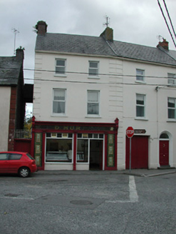 D. MurphyHouse · 27 yd
 CrossCross, High cross · 132 yd
 The Yellow GateMemorial · 183 yd
 John Patrick KennedyMemorial · 524 yd
 CastleCastle, Anglo-Norman masonry castle · 934 yd
 Jerpoint AbbeyHeritage attraction · 1.3 mi
 Holy WellSpring · 1.4 mi
 Dysart Castle (in Ruins)Castle, tower house · 1.7 mi
 Horse-chestnut1.9 mi
 Pedunculate Oak2.0 mi
More historic places in County Kilkenny · All of County Kilkenny
What do you know about this place?