What is recorded here
The castle (LI023-080----) and bawn was described in 1826 as 'an ancient building consisting of a bawn 180 feet [55m] long and 120 feet [36.5m] wide, the wall of which is twelve feet [3.6m] high and four feet [1.2m] thick. Within the bawn is a strong house of lime and stone, three stories high, and eighty feet long by thirty in breadth; at each of the four angles is a square tower with port holes; and it is conjectured from its stone window frames and flankers, to have been built in the reign of James I' (Fitzgerald 1826, 304-5). I
n 1840 the Ordnance Survey recorded that 'there was a castle [LI023-080----] here built about the time of James I. by the Rawleys. It fell into decay and became the property of the Croker family, who built a splendid house out of its ruins about 75 years ago. This house was afterwards sold to one of the labourers employed in building it for £200, and he immediately destroyed it, leaving it the ruin it is today' (OSNB Cahercorney parish). Rawleystown Court described by Westropp (1906-7, 186) as following; 'The enclosure is about 180 feet [55m] by 120 feet [36.5m]; it has a square turret with loopholes at each corner, and walls 12 feet [3.6m] high and 4 feet [1.2m] thick. Within is a strong house, 80 feet [24m] by 30 feet [9m], of three stories. The two Down Survey maps show it as a battlemented peel tower in a square court, with turrets at each angle'. Described in 1943 as following; 'This is the ruin of a fortified dwelling. All that now remains is one gable wall and fragments of an enclosing court-yard wall. No architectural features survive which would indicate the date of erection' (O'Kelly 1942-3, 183). The outline of the bawn or courtyard wall is visible today on Digital Globe aerial photographs. The 1654-56 Civil Survey of Limerick recorded that on the lands of Redmond Rawly, Margarett Rawly & Ellan Rawly there stood 'a Ruinous Castle, 20 Cabbins & a Mil Seat' (Simington 1938, 108). The 1654-7 Down Survey map of Cahircorney parish shows a tower house like structure standing in the centre of a bawn with four angle towers (NLI, MS 718). This castle and bawn are also depicted in a similar style on the Down Survey map of Small Barony (ibid.). See attached Down Survey images showing the castle and bawn of Rawleystown.
The castle (LI023-080----) and bawn was described in 1826 as 'an ancient building consisting of a bawn 180 feet [55m] long and 120 feet [36.5m] wide, the wall of which is twelve feet [3.6m] high and four feet [1.2m] thick. Within the bawn is a strong house of lime and stone, three stories high, and eighty feet long by thirty in breadth; at each of the four angles is a square tower with port holes; and it is…
From the National Monuments Service (Archaeological Survey of Ireland) record LI023-080001
The monument record does not grant public access. Check the route and ask the landowner before entering private land.
- What survives
- Recorded monument
Places near here
Photo credits
- National Inventory of Architectural Heritage
- Oliver Dixon, Geograph · CC BY-SA 2.0
- Martin Richard Phelan, Geograph · CC BY-SA 2.0
- deiseal, Wikimedia Commons · CC BY-SA 2.0
- Algirdas at Lithuanian Wikipedia, Wikimedia Commons · Public domain
- David Hawgood, Wikimedia Commons · CC BY-SA 2.0
- Ruhrfisch, Wikimedia Commons · CC BY-SA 4.0
- No machine-readable author provided. Christian1965~commonswiki assumed (based on copyright claims)., Wikimedia Commons · Public domain
- Dylan Moore, Geograph · CC BY-SA 2.0
- Garry Dickinson, Geograph · CC BY-SA 2.0
 Longford BridgeBridge · 1187 yd
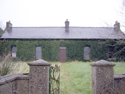 Lake ViewHouse · 1201 ydCaherelly CastleCastle · 1431 yd
 The SpectaclesVisitor information · 1453 yd
 Lough Gur Heritage CentreVisitor information · 1507 yd
 Bolin IslandCrannog · 1682 yd
 Pedunculate Oak1.0 mi
 Stone CirclesStone circle · 1.8 mi
 Grange Stone CircleArchaeological place · 1.9 mi
 Lough GurVisitor information · 1.9 mi
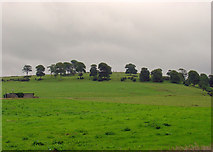 KnockainyMountain / peak · 4.1 mi
 CastleCastle, motte and bailey · 6.4 mi
More castles and forts in County Limerick · All of County Limerick
What do you know about this place?