
What is recorded here
Recorded construction date: 1880 - 1899. Current recorded use: House.
From the Northern Ireland Historic Buildings Record record HB09/05/027
The official record and map point do not grant access. Many historic buildings are privately owned; view them only from public ground unless the owner allows entry.
Places near here
 Graveyard in DonaghriskGraveyard · 954 ydFortified house in LoughryFortified House · 1058 yd
 Holy well: friar's well in DonaghriskHoly Well: Friar's Well · 1085 yd
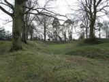 Historic Settlement Tullyhogue in TullaghogeHistoric Settlement Tullyhogue · 1379 yd
 Sandholes Presbyterian ChurchChurch · 1.6 mi
 Derryloran Old ChurchRuins · 2.1 mi
 Multiperiod Church & Graveyard: Derryloran Church, Daire-lurain, Doire-lurain, Daire-lubrain in GlebeMultiperiod Church & Graveyard: Derryloran Church, Daire-lurain, Doire-lurain, Daire-lubrain · 2.1 mi
 Castle: roughan castle in RoughanCastle: Roughan Castle · 3.3 mi
 Drum Manor Forest ParkWood · 4.3 mi
 Clonoe ambushTerrorist attack · 4.8 mi
 Wellbrook Beetling MillHeritage attraction · 5.3 mi
 Coagh ambushAmbush · 5.8 mi
Pictures: HENRY CLARK, Geograph · Creative Commons Attribution-ShareAlike 2.0; HENRY CLARK, Wikimedia Commons · CC BY-SA 2.0; Linda Bailey, Wikimedia Commons · CC BY-SA 2.0; Kenneth Allen, Geograph · CC BY-SA 2.0; dougf, Geograph · CC BY-SA 2.0; Kenneth Allen, Wikimedia Commons · CC BY-SA 2.0
More historic places in County Tyrone · All of County Tyrone
What do you know about this place?