
What is recorded here
Recorded construction date: 1860 - 1879. Current recorded use: Hall.
From the Northern Ireland Historic Buildings Record record HB11/12/005
Places near here
Picture notes
- Kenneth Allen, Wikimedia Commons · CC BY-SA 2.0
- Computer-made picture. It does not show this playground.
- Jeanne Boleyn ( talk ), Wikimedia Commons · Public domain
- Computer-made picture. It does not show this monument.
- Computer-made picture. It does not show this walking route.
- Kenneth Allen, Geograph · CC BY-SA 2.0
- Computer-made picture. It does not show this mountain top.
- Liam Hughes from Milwaukee, WI, USA, Wikimedia Commons · CC BY 2.0
 Bell's BridgeBridge · 178 yd
 Ulster BankBank · 289 yd
 Children's playground321 ydComputer-made picture
 Omagh bombingTruck bombing · 337 yd
 Franciscan friary in OmaghFranciscan Friary · 346 ydComputer-made picture
 Artillery fort in OmaghArtillery Fort · 346 ydComputer-made picture
 Killyclougher Burn WalkWalking route · 1.7 miComputer-made picture
 Ulster WayWalking route · 1.8 miComputer-made picture
 Church & graveyard in Drumragh (caldwell)Church & Graveyard · 2.0 mi
 SlieveardMountain / peak · 4.2 miComputer-made picture
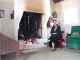 Ulster American Folk ParkMuseum · 4.2 mi
 Church & graveyard: cappagh church or old church in DunmullanChurch & Graveyard: Cappagh Church or Old Church · 4.5 mi
More historic places in County Tyrone · All of County Tyrone

What do you know about this place?Tap to add a comment or ask a question