
What is recorded here
Map note: In County Tyrone, Ireland, the map records Omagh Boating Lake as a park. It made the map, and that is an invitation to be curious.
From OpenStreetMap (© OpenStreetMap contributors) w735006825
Places near here
Photo credits
- Kenneth Allen, Wikimedia Commons · CC BY-SA 2.0
- Jeanne Boleyn ( talk ), Wikimedia Commons · Public domain
- Kenneth Allen, Geograph · Creative Commons Attribution-ShareAlike 2.0
- Kenneth Allen, Geograph · CC BY-SA 2.0
- Liam Hughes from Milwaukee, WI, USA, Wikimedia Commons · CC BY 2.0
- Gordon Dunn, Wikimedia Commons · CC BY-SA 2.0
 Lisnamallard HouseOffice · 107 yd
 Bank of IrelandBank · 188 yd
 Garden of LightPark · 389 yd
 Omagh bombingTruck bombing · 420 yd
 Platform rath in CrannyPlatform Rath · 1.1 mi
 Counterscarp rath in BallygowanCounterscarp Rath · 1.6 mi
 Church & graveyard in Drumragh (caldwell)Church & Graveyard · 1.9 mi
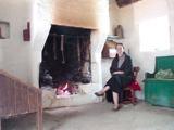 Ulster American Folk ParkMuseum · 4.4 mi
 Church & graveyard: cappagh church or old church in DunmullanChurch & Graveyard: Cappagh Church or Old Church · 4.6 mi
 History of Gortin Glen ForestVisitor information · 6.0 mi
 MullaghcarnMountain / peak · 6.0 mi
 Plantation Castle: Castle Curlews in KirlishPlantation Castle: Castle Curlews · 8.7 mi
More things to do in County Tyrone · All of County Tyrone

What do you know about this place?Tap to add a comment or ask a question