
Places near here
Photo credits
- National Inventory of Architectural Heritage
- Algirdas at Lithuanian Wikipedia, Wikimedia Commons · Public domain
- kevin higgins, Wikimedia Commons · CC BY-SA 2.0
- kevin higgins, Geograph · CC BY-SA 2.0
- A.-K. D., Wikimedia Commons · CC BY-SA 4.0
- This Photo was taken by Wolfgang Moroder . Feel free to use my photos, but please mention me as the author and send me a message . This image is not in the public domain . Please respect the copyright protection. It may only be used according to the rules mentioned here. This specifically excludes use in social media , if applicable terms of the licenses listed here not appropriate. Please do not upload an updated image here without consultation with the Author. The author would like to make corrections only at his own source. This ensures that the changes are preserved. Please if you think that any changes should be required, please inform the author. Otherwise you can upload a new image with a new name. Please use one of the templates derivative or extract ., Wikimedia Commons · CC BY-SA 3.0
- A.-K. D., Wikimedia Commons
- Mike Searle, Wikimedia Commons · CC BY-SA 2.0
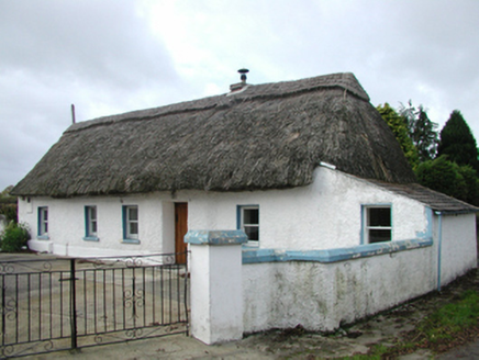 farm house438 yd
Explorer Tom Farm house in Whitehouse was built on a bargain where the stones were free if you carried them yourself. The oat thatch…
 Pedunculate Oak1.0 mi
Explorer Tom Pedunculate Oak in County Tipperary has an imaginary fan club consisting entirely of squirrels who are too busy eating…
 Killaloe BridgeBridge · 1.1 mi
Explorer Tom Killaloe Bridge was started by two lads in the pub who bet they could build it before their next pint was ready, which…
 Saint Molua's Catholic ChurchChurch/chapel · 1.1 mi
Explorer Tom Saint Molua's Catholic Church in Killaloe, County Kilkenny makes a spooky creaking sound at night. It’s probably just…
 Church in KillaloeChurch · 1.1 mi
Explorer Tom Church in Killaloe would ace a job interview with its tragic backstory. It was demolished so the new one could get the…
 TobermoluaHoly well · 1.2 mi
Explorer Tom Tobermolua in Kylenaskeagh had a bishop who refused to visit because he thought the parking situation was terrible. The…
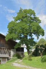 Black Locust1.4 mi
Explorer Tom Black Locust in County Tipperary thinks the local rabbits are just trying to eat their way into the royal court…
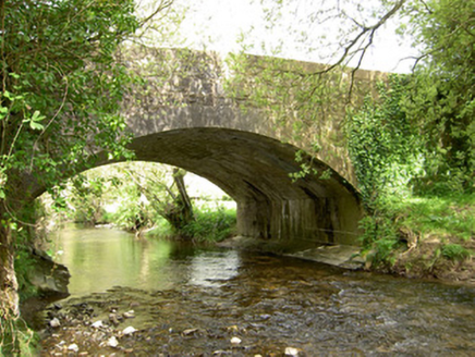 Cappagh BridgeBridge · 1.4 mi
Explorer Tom Cappagh Bridge is called 'Cappagh' because a guy named Cap once got stuck in his pants there; nobody can prove it, but…
 Edmund Rice Heritage CentreMuseum · 2.4 mi
Explorer Tom The Edmund Rice Heritage Centre at Westcourt begins with a thatched family house near Callan, not a grand hall built…
 Humphrey O'SullivanMemorial · 3.1 mi
Explorer Tom Humphrey O'Sullivan was a schoolmaster in County Kilkenny who died in 1838, which means he probably had the worst class…
 ToberbrideHoly well · 3.4 mi
Explorer Tom Toberbride is where St. Bridget held parties that lasted all night. A bishop refused to come because he thought the…
 Killaghy CastleCastle, tower house · 5.2 mi
Explorer Tom Killaghy Castle would complain to the council about the lack of maintenance, even though it’s basically gone missing…
More archaeology and monuments in County Kilkenny · All of County Kilkenny

What do you know about this place?Tap to add a comment or ask a question