
What is recorded here
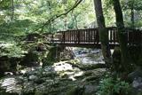
Recorded construction date: 1720 - 1739. Current recorded use: Bridge.
From the Northern Ireland Historic Buildings Record record HB18/13/030
The official record and map point do not grant access. Many historic buildings are privately owned; view them only from public ground unless the owner allows entry.
Places near here
Photo credits
- Eric Jones, Wikimedia Commons · CC BY-SA 2.0
- Eric Jones, Geograph · CC BY-SA 2.0
- Norman Ekin, Geograph · CC BY-SA 2.0
- Ardfern, Wikimedia Commons · CC BY-SA 3.0
- Rossographer, Geograph · CC BY-SA 2.0
 Horn BridgeBridge · 279 yd
 Foley's BridgeBridge · 321 yd
 Tollymore Forest - Arboretum PathWalking route · 458 yd
 The DrinnsViewpoint · 758 yd
 The DrinnsMountain / peak · 949 yd
 CurraghardMountain / peak · 999 yd
 Tollymore ForestForest · 1009 yd
 Tollymore Forest - Mountain TrailWalking route · 1010 yd
 Tollymore Forest Park EntranceNature reserve · 1234 yd
 CurraghardViewpoint · 1414 yd
 Tipperary WoodsForest · 1.5 mi
 Maghera Church and Round TowerArchaeological place · 2.0 mi
More historic places in County Down · All of County Down
What do you know about this place?