What is recorded here
Oak Bush is a tree in Scottish Borders, Scotland.
Places near here
Photo credits
- Gordon Brown, Wikimedia Commons · CC BY-SA 2.0
- Stanley Howe, Wikimedia Commons · CC BY-SA 2.0
- JThomas, Wikimedia Commons · CC BY-SA 2.0
- Jim Barton, Wikimedia Commons · CC BY-SA 2.0
- Jonathan Thacker, Wikimedia Commons · CC BY-SA 2.0
- Walter Baxter, Wikimedia Commons · CC BY-SA 2.0
- James T M Towill, Wikimedia Commons · CC BY-SA 2.0
- Iain Lees, Wikimedia Commons · CC BY-SA 2.0
 Capon TreeTree (medieval) · 399 yd
 Hundalee BridgeRoad Bridge · 447 yd
 Sunnybraescaur PlantationForest · 562 yd
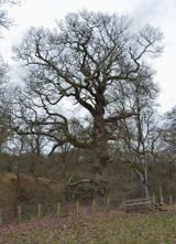 King of the WoodOak · 576 yd
 JedburghFindspot, Unidentified Flint(s) (flint) · 1114 yd
 Jedburgh, Blaikup StoneInscribed Stone · 1135 yd
 Ferniehurst CastleCastle (medieval), Chapel (17th Century), Garden Wall(s) (17th Century), Gateway (17th Century) · 1253 yd
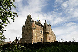 Ferniehirst CastleCastle · 1259 yd
 Jedburgh AbbeyBoundary Wall · 1520 yd
 Jedburgh War MemorialMemorial · 1574 yd
 Jedburgh, Exchange StreetNo Class (event) · 1634 yd
 Jubilee FountainMemorial · 1715 yd
More archaeology and monuments in Scottish Borders · All of Scottish Borders

What do you know about this place?Tap to add a comment or ask a question