
What is recorded here
Hundalee Bridge is a road bridge in Scottish Borders, Scotland.
From the Historic Environment Scotland record 306806
The historic-place record does not grant public access. Check current conditions and ownership before entering land or a building.
Places near here
 Capon TreeTree (medieval) · 92 yd
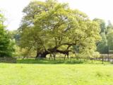 Capon TreeSessile Oak · 92 yd
 Sunnybraescaur PlantationForest · 119 yd
 King of the WoodTree (medieval) · 278 yd
 FerniehurstQuarry(s) (medieval) (possible) · 513 yd
 Ferniehurst CastleCastle (medieval), Chapel (17th Century), Garden Wall(s) (17th Century), Gateway (17th Century) · 1035 yd
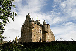 Ferniehirst CastleCastle · 1043 yd
 Jedburgh, Blaikup StoneInscribed Stone · 1188 yd
 Jedburgh AbbeyBoundary Wall · 1608 yd
 Jedburgh War MemorialMemorial · 1644 yd
 Jedburgh AbbeyFindspot, Core (flint) · 1670 yd
 Jedburgh, Exchange StreetNo Class (event) · 1752 yd
Pictures: Gordon Brown, Wikimedia Commons · CC BY-SA 2.0; Ewen Rennie, Wikimedia Commons · CC BY-SA 2.0; JThomas, Wikimedia Commons · CC BY-SA 2.0; Walter Baxter, Wikimedia Commons · CC BY-SA 2.0; James Denham, Wikimedia Commons · CC BY-SA 2.0; Jonathan Thacker, Wikimedia Commons · CC BY-SA 2.0; Jim Barton, Wikimedia Commons · CC BY-SA 2.0; James T M Towill, Wikimedia Commons · CC BY-SA 2.0; Iain Lees, Wikimedia Commons · CC BY-SA 2.0
More historic places in Scottish Borders · All of Scottish Borders
What do you know about this place?