
More pictures of this place


What is recorded here
Freestanding single-bay two-stage tower, built 1835, on a circular plan with single-bay two-stage lower turret (west) on a circular plan. In ruins, 1942. Roofs not visible behind parapets. Repointed coursed cut-limestone walls on battered base with cut-limestone stringcourse supporting battlemented parapet having cut-limestone coping; repointed coursed cut-limestone walls (turret) with concrete coping to parapet. Square-headed window openings with shallow sills, and cut-limestone lintels with hood mouldings framing timber casement windows. Square-headed window openings (turret) with shallow sills, and cut-limestone lintels with hood mouldings framing timber casement windows. Set on cut-limestone stepped podium on clifftop. NOTE: Erected by Cornelius O'Brien MP (1782-1857) 'for the accommodation of visitors [who obtain] a magnificent view embracing the whole line of coast from Loop Head to the northern extremity of the bay of Galway together with the Arran Isles and a vast expanse of the Atlantic Ocean' (Lewis 1837 II, 166). Originally larger with a second single-stage tower showing a diadem-like battlemented parapet as captured in a photograph by Robert French (1841-1917) of Dublin [NLI L_CAB_06217]; the second tower had collapsed by the time O'Brien's Tower was photographed (1942) by the Irish Tourist Association [NLI ITA 269/1].
The story behind this place
Repointed coursed cut-limestone walls on battered base with cut-limestone stringcourse supporting battlemented parapet having cut-limestone coping; repointed coursed cut-limestone walls (turret) with concrete coping to parapet.
From the Buildings of Ireland (National Inventory of Architectural Heritage) record 20401408
This does not grant access. Most recorded buildings are privately owned; view them only from public ground unless the owner allows entry.
Places near here
 O'Brien's TowerHeritage attraction · 33 yd
 Sea StackMountain / peak · 234 yd
 Cliffs of Moher Visitor CentreVisitor information · 421 yd
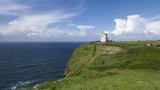 Cliffs of MoherCliff · 1.0 mi
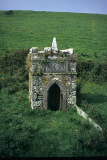 Spa WellWell · 1.3 mi
 St Bridgets WellHoly well · 1.5 mi
 Bridget's Well;St Bridget's WellSpring · 1.5 miSaint Bridget's WellHoly well · 1.5 mi
 O’Briens MonumentMonument · 1.5 mi
 Sightseeing Cliffs of Moher SouthViewpoint · 2.3 mi
 Doonagore Castle in ruinsCastle, tower house · 2.8 mi
 Ballaghaline PointHeadland · 3.0 mi
Pictures: Frabjousone, Wikimedia Commons · CC BY-SA 4.0; Gareth James, Geograph · CC BY-SA 2.0; Joseph Mischyshyn, Geograph · CC BY-SA 2.0; Berthold Werner, Wikimedia Commons · CC BY-SA 4.0; National Inventory of Architectural Heritage; Liscannorman, Wikimedia Commons · CC BY-SA 3.0; John M, Geograph · CC BY-SA 2.0; Colin Park, Geograph · CC BY-SA 2.0; Valfex, Wikimedia Commons · CC BY-SA 3.0; Bob Jones, Geograph · CC BY-SA 2.0
More historic places in County Clare · All of County Clare
What do you know about this place?