What is recorded here
Situated on the N side of Fairview Crescent and continuing to E and W, in the Singland/Garryowen area of Limerick city. Potentially following the N side of Fairview Crescent, which is adjacent to the site of the Garryowen Reservoir (Limerick Waterworks), which in turn is understood to be on the site of a star-shaped…
Read the whole record
From the National Monuments Service (Archaeological Survey of Ireland) record LI005-087
Places near here
Photo credits
- David Hawgood, Geograph · Creative Commons Attribution-ShareAlike 2.0
- vincent campbell, Wikimedia Commons
- National Inventory of Architectural Heritage
- Claughaun GAA club; individual photographers not named, claughaungaa.com
- Maker not stated on source page, www.tripadvisor.com.au
- Maker not stated on source page, www.dreamstime.com
- Original uploader was Poxyshamrock at en.wikipedia, Wikimedia Commons · Public domain
- Maker not stated on source page, www.pinterest.com
- David Hawgood, Geograph · CC BY-SA 2.0
 Saint Joseph's HospitalHospital/infirmary · 499 yd
Explorer Tom Saint Joseph's Hospital in Limerick has a secret pride in one specific potato. It was built for the insane, so imagine…
 Markets Field StadiumLeague of Ireland ground · 652 yd
Explorer Tom Markets Field keeps Limerick football close enough to hear the shouts from the far touchline. Treaty United call this…
 magazine886 yd
Explorer Tom Magazine in Limerick was built by a guy who thought 'defensive' meant 'make it look like a angry fortress.' The builder…
 Claughaun GAA pitchGAA ground · 912 yd
 St. Johns ChurchChurch · 1024 yd
Explorer Tom St. Johns Church in Irishtown would write 'Looking for someone who doesn't ask too many questions' on its dating…
 TombTomb, chest tomb · 1027 yd
Explorer Tom Tomb at Irishtown belongs to Thomas Rice, who apparently saved the church from a giant badger in 1622. No one remembers…
 Coláiste MhichílSchool · 1052 yd
Explorer Tom Coláiste Mhichíl would teach history by making you run laps around the building until you confess. It’s marked as City…
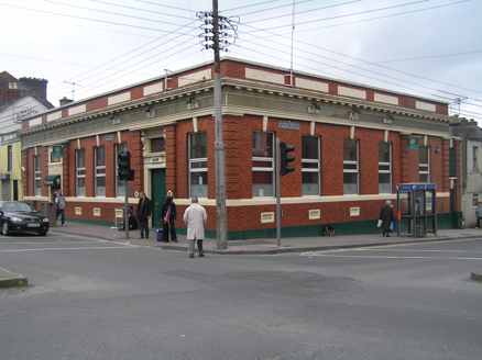 Allied Irish BankBank/financial institution · 1194 yd
Explorer Tom Allied Irish Bank in Limerick has very strong opinions about modern buildings and thinks they are all terrible taste.…
 Colbert Railway StationRailway station · 1313 yd
Explorer Tom Colbert Railway Station has a local sheep who rates the architecture five stars out of five, apparently. It was built…
 shop/retail outlet1335 yd
Explorer Tom Roches Street shop in Limerick is probably rearranging its window displays when nobody’s looking. That Victorian height…
 Mount Saint Oliver CemeteryCemetery · 1.0 mi
Explorer Tom Mount Saint Oliver Cemetery in County Limerick has had so many former names it needs a calendar just to remember them…
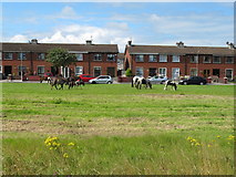 King's IslandIsland · 1.3 mi
Explorer Tom King's Island is the bit of Limerick the rivers drew for themselves. The Abbey River leaves the Shannon and joins it…
More historic places in County Limerick · All of County Limerick

What do you know about this place?Tap to add a comment or ask a question