
What is recorded here
Identified during archaeological monitoring associated with the N20/N21 Limerick Bypass road scheme. Excavated under licence no. 99E0067 by Ciara MacManus (MacManus 1999) the results were summarised as following; ‘The fulacht fiadh survived as a mound of burnt stones and charcoal-rich soil, 18.94m long, 14m wide and…
Read the whole record
From the National Monuments Service (Archaeological Survey of Ireland) record LI013-236
Places near here
Photo credits
- National Inventory of Architectural Heritage
- Mike Searle, Wikimedia Commons · CC BY-SA 2.0
- Bartlett, W. H. (William Henry) H. Griffiths (engraver), Wikimedia Commons · Public domain
- Jon Sullivan, Wikimedia Commons · Public domain
- Joseph Mischyshyn, Geograph · Creative Commons Attribution-ShareAlike 2.0
- Miguel Angel Masegosa Martínez, Wikimedia Commons · CC BY 2.0
- No machine-readable author provided. Christian1965~commonswiki assumed (based on copyright claims)., Wikimedia Commons · Public domain
- Colin Park, Geograph · CC BY-SA 2.0
- Darrin Antrobus, Wikimedia Commons · CC BY-SA 2.0
- Greg and Cindy, Wikimedia Commons · CC BY 2.0
- Dylan Moore, Geograph · CC BY-SA 2.0
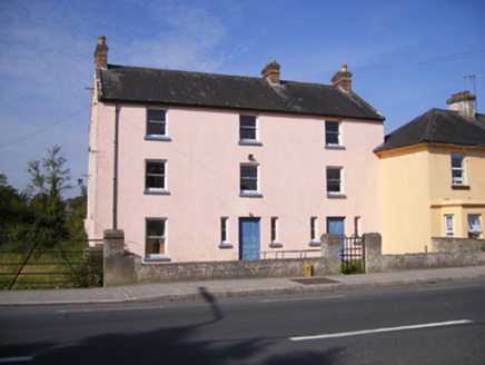 Ric barracks625 yd
Explorer Tom Ric barracks in Ballyanrahan East would say in a job interview that it’s very stable and doesn’t need overtime pay. It’s three stories tall while everyone else is two, so it stands out like a sore thumb. Stick around for the history lesson if you can.
 Duane VillePresbytery/parochial/curate's house · 867 yd
Explorer Tom Duane Ville in Ballyanrahan East thinks it was built for a famous actor who just never turned up. It’s still waiting on the sequel to its life story. Tell it a joke, it's been a long wait for applause from anyone but ghosts.
 Ballinveala Castle (in ruins)Castle, tower house · 2.6 mi
Explorer Tom Ballinveala Castle nearly got famous when someone almost found it but looked in the wrong field. It’s four stories of brickwork pretending to be taller than it actually is. Take the long way round, it deserves the effort.
 Carrigogunnel Castle (in ruins)Castle, Anglo-Norman masonry castle · 3.6 mi
Explorer Tom Carrigogunnel Castle would spend its lotto win on a really good hat to hide from the rain. It’s been sitting on a rock since the days when people wore fur coats indoors. Pick a stone, any stone, and invent its biography.
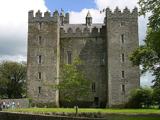 Bunratty CastleCastle · 8.1 mi
Explorer Tom Bunratty Castle, or Caisleán Bhun Raithe as the locals call it when they are feeling fancy. We are standing in a big 15th-century tower house in County Clare, right by the N18 road between Limerick and Ennis. It sits smack in the middle of the village, which means no muddy walk through the bog, just a short stroll. You can see it from the car park, looking like it is about to swallow the sky. The stone is thick, the history is deep, and the vibes are purely medieval. People say it has hosted kings and queens, which sounds about right for a place this grand. It is not some ruin you have to imagine, it is fully there, ready to judge your outfit. Come and see what all the fuss is about, just bring a coat, it gets chilly in here.
 Graveyard8.2 mi
Explorer Tom Graveyard in Bunratty West is hanging out right behind the castle hotel, which feels like standing in someone's kitchen. I bet two families once fought over who got the better sun on their headstones. Look up, because the best gossip is always above your eye level.
 Sweet Chestnut8.5 mi
Explorer Tom Sweet Chestnut hiding a scandal from centuries ago that nobody has bothered to ask about yet. A handy spot to stretch your legs and your imagination.
 Áine and Gearóid Iarla: Lough GurLegend location · 9.2 mi
Explorer Tom Áine and Gearóid Iarla: Lough Gur has a goddess for the lake and a sleeping lord in the old stories. I thought I was coming to admire water and stones. Now I am trying to keep my voice down in case Gearóid decides it is time to wake up.
 KnockfeerinaMountain / peak · 9.8 mi
 Atlantic Air VentureMuseum · 11 mi
Explorer Tom Atlantic Air Venture is a tribute to aviation's golden age, where the air's past is preserved in County Clare's museum.
 Pan Am Flight 1-10Aviation accident · 12 mi
Explorer Tom Pan Am Flight 1-10 in County Clare took a shortcut that wasn't one. It’s a classic mistake. Go back in winter, it's a different animal.
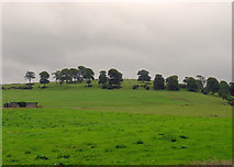 KnockainyMountain / peak · 13 mi
More archaeology and monuments in County Limerick · All of County Limerick

What do you know about this place?Tap to add a comment or ask a question