
What is recorded here
From the National Monuments Service (Archaeological Survey of Ireland) record CL065-129
Places near here
Photo credits
- Maker not stated on source page, www.pinterest.com
- National Inventory of Architectural Heritage
- Maker not stated on source page, www.bbc.com
- Roger Diel, Geograph · CC BY-SA 2.0
- Maker not stated on source page, en.wikipedia.org
- N Chadwick, Geograph · CC BY-SA 2.0
- Maker not stated on source page, ca.pinterest.com
- Gordon Hatton, Geograph · CC BY-SA 2.0
- Neil Theasby, Geograph · CC BY-SA 2.0
- Graham Horn, Geograph · CC BY-SA 2.0
- Wikimedia Commons contributor · Public domain
 Standing stoneStanding stone, pair · 1 yd
Explorer Tom Standing stone pair in Oughterard are like two friends who refuse to sit together at dinner. A bird refuses to leave…
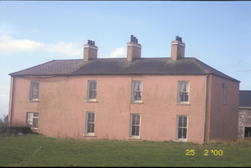 Kilballyowen HouseHouse · 460 yd
Explorer Tom Kilballyowen House had its bay window removed in 1980, which is like chopping off your own nose because you didn't like…
 Naomh Eoin GAA pitchGAA ground · 1515 yd
 Cloghaunsavaun Castle (Site of)Castle, unclassified · 1.6 mi
Explorer Tom Cloghaunsavaun Castle protected a promontory overlooking the Atlantic, but now it’s just a memory with a great view of…
 Fairy fort / earthen ringfort in Cloghaunsavaun,ross (moyarta By.)Fairy fort / earthen ringfort · 2.0 mi
Explorer Tom Fairy fort / earthen ringfort in Cloghaunsavaun, Ross is constantly getting picked on by the wind. It’s an earthen…
 Grave of the Yellow MenMemorial · 2.2 mi
Explorer Tom Grave of the Yellow Men would tell the place that replaced it to stop hogging all the tourist attention and learn some…
 Graveyard in Ross (moyarta By.)Graveyard · 2.8 mi
Explorer Tom Graveyard in Ross has had so many names that even its own stones are confused about who they’re supposed to be…
 Bridges of RossVisitor information · 2.9 mi
Explorer Tom Bridges of Ross in County Clare is where a bishop once refused to cross because he thought the water looked too…
 Bridge of RossViewpoint · 3.2 mi
Explorer Tom The Bridge of Ross stands on Clare's Atlantic edge as a natural stone arch, the stubborn survivor of a group the sea…
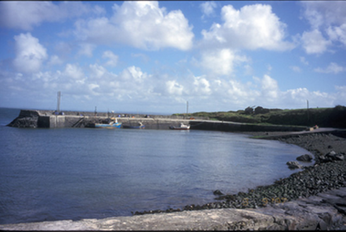 pier/jetty3.2 mi
Explorer Tom Pier or jetty in Kilbaha South has been lying there since 1850, minding its own business with some fancy bollards. I…
 Dunmore HeadHeadland · 4.8 mi
Explorer Tom Dunmore Head is shouting at the place that replaced it, saying it had more character and didn’t need a fancy name to…
 Banna StrandBeach / strand · 18 mi
Explorer Tom Banna Strand has enough sand for my footprints to disappear before I can boast about the distance walked. The beach…
More archaeology and monuments in County Clare · All of County Clare

What do you know about this place?Tap to add a comment or ask a question