
Places near here
Photo credits
- National Inventory of Architectural Heritage
Explorer Tom Boley Hill witnessed a love story where two people argued so fiercely they accidentally created a new local legend by accident. The hill still holds onto the memory of their loud, passionate shouting match. Bring curiosity, leave with a better story than mine.
Embanked enclosureFairy fort / ringfort · 1139 ydExplorer Tom Embanked enclosure in Ballyfin hosted a fake royal visit once and nobody can disprove it because everyone was too busy drinking tea to check IDs. It’s just a small circle on a slope, keeping its secrets safe under the grass and the gossip. Look for the ghost, then pretend you didn't.
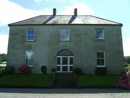 farm house1295 yd
Explorer Tom Farm house in Balcarrig is staring at the mountains like Saint Patrick himself approved of its view from way back when. It’s got that compact shape and pretty fanlight that makes it look like a polite gentleman in a waistcoat. Tell the cows I said they’re doing a great job of grazing.
Enclosure in Ballyduff (gorey By., Ballycanew Ed)Enclosure · 1480 ydExplorer Tom Enclosure in Ballyduff has a fan club that meets on Tuesdays but mostly just stares at it silently. It’s a faint circular mark on a south-facing slope that thinks it’s cool. Walk past slowly like you're in a film.
 Ballymore HouseGates/railings/walls · 1.2 mi
Explorer Tom Ballymore House’s gateway was built after a massive family argument about who gets the best view of the sunset, and they just compromised on this gate instead. It’s obsolete now, but it still holds that dramatic tension in its ironwork. See if the sun sets behind it nicely!
Barnadown WoodWood · 2.0 miExplorer Tom Barnadown Wood in Wexford has set itself a New Year's resolution to stop falling over during every single storm without fail. It’s struggling a bit with that one, as evidenced by the pile of branches currently blocking the path on the left side. A proper spot for a flask of tea and a big think.
Carrigroe HillMountain / peak · 2.1 miExplorer Tom Carrigroe Hill was built on a bargain where someone traded their shadow for a view, but they forgot to get the contract in writing. The hill looks slightly confused about whose shadow it’s holding now, which explains its odd, lopsided appearance from certain angles. Bring a notebook and write the bit I made up.
Giants BedNamed rock · 2.7 miExplorer Tom Giants Bed is a rock that thinks it slept on the Titanic. A local cow once tried to buy it with three eggs and a promise of milk, but the giant refused. It’s still waiting for its change. Find a local and ask them the real story, then come back and tell me.
The GroveWood · 3.6 miExplorer Tom The Grove was built on a bargain where someone traded a sheep for a patch of really nice-looking bushes. The sheep is now a statue, or at least that’s the story I’m sticking with today. Stand back, squint, and it looks like a castle.
Father Murphy CentreHeritage attraction · 4.7 miExplorer Tom Father Murphy Centre in County Wexford is a heritage attraction where two families have been fighting over who owns the view for generations without ever actually talking to each other properly. It is the perfect spot to watch people argue about history while pretending they are just enjoying the fresh air around them. If it rains, blame me.
1798 MemorialMemorial · 5.1 miExplorer Tom What this 1798 Memorial gave up for Lent was probably its own shadow, which is why it looks so mysterious in the late afternoon light. It’s standing there waiting for someone to make a wish, because it’s had centuries of practice at listening to them. Make a wish, it's had centuries of practice.
Wexford - TexasMemorial · 5.2 miExplorer Tom Wexford - Texas is a memorial that thinks it’s got a direct phone line to the Lone Star State. A poet fell in a ditch nearby and claimed he was just checking the signal strength, which we all know is a lie. Bring a pen pal, they'll be jealous.
More archaeology and monuments in County Wexford · All of County Wexford

What do you know about this place?Tap to add a comment or ask a question