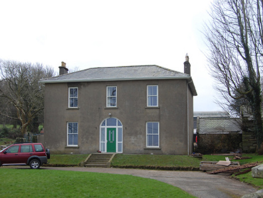
What is recorded here
Detached three-bay two-storey farmhouse, extant 1909, on a T-shaped plan with single-bay (single-bay deep) two-storey lower central return (south). Renovated, 2010. Hipped slate roof centred on pitched slate roof (south) with clay or terracotta ridge tiles, rendered chimney stacks having moss-covered stepped capping supporting yellow terracotta tapered pots, and replacement uPVC rainwater goods on timber eaves boards on box eaves retaining cast-iron octagonal hoppers and downpipes. Rendered, ruled and lined walls. Round-headed central door opening approached by flight of six cut-granite steps with concealed dressings framing replacement glazed panelled door having sidelights below overlight. Square-headed window openings with cut-granite sills, and concealed dressings framing replacement two-over-two sash windows. Set in landscaped grounds with rendered piers to perimeter having "mushroom" capping supporting tubular steel "farm gate".
A farmhouse representing an integral component of the domestic built heritage of south County Dublin with the architectural value of the composition, one potentially retaining the basis of an earlier house displaying an abbreviated footprint on the first edition of the Ordnance Survey (surveyed 1837; published 1843), suggested by such attributes as the deliberate alignment maximising on scenic vistas overlooking rolling grounds; the compact plan form centred on a somewhat featureless doorcase; and the diminishing in scale of the openings on each floor producing a graduated tiered visual effect. Having been well maintained, the elementary form and massing survive intact together with quantities of the original or replicated fabric, thus upholding much of the character or integrity of the composition. Furthermore, adjacent outbuildings (extant 1909) continue to contribute positively to the group and setting values of a self-contained ensemble making a pleasing visual statement in a rural street scene.
From the Buildings of Ireland (National Inventory of Architectural Heritage) record 60250017
This does not grant access. Most recorded buildings are privately owned; view them only from public ground unless the owner allows entry.
Places near here
 kiln374 yd
 Ballyedmonduff Wedge TombArchaeological place · 892 yd
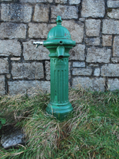 water pump998 ydBallyedmonduff ForestForest · 1503 yd
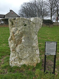 Glencullen Standing StoneArchaeological place · 1657 ydBallybetagh WoodForest · 1.1 mi
 Three Rock MountainMountain / peak · 1.2 mi
 Two Rock MountainMountain / peak · 1.2 miTicknock - Fairy Castle LoopWalking route · 1.6 mi
 Wicklow WayWalking route · 1.7 mi
_(cropped).jpg/250px-Kilgobbin_Castle,_County_of_Dublin,_1834_(IA_jstor-30004185)_(cropped).jpg "Photo: Wikimedia Commons contributor · Public domain") Kilgobbin CastleCastle · 1.8 miBallycorus castle Site ofCastle, tower house · 1.9 mi
Kilgobbin CastleCastle · 1.8 miBallycorus castle Site ofCastle, tower house · 1.9 miPictures: National Inventory of Architectural Heritage; Joe King, Wikimedia Commons · CC BY-SA 3.0; Sheila1988, Wikimedia Commons · CC0; JP, Geograph · CC BY-SA 2.0; Barry, Geograph · CC BY-SA 2.0; Wikimedia Commons contributor · Public domain
More historic places in County Dublin · All of County Dublin
What do you know about this place?