
Places near here
Photo credits
- National Inventory of Architectural Heritage
- Kenneth Allen, Wikimedia Commons · CC BY-SA 2.0
- Dromahair Arts and Recreation Centre (publisher); individual photographer not stated, discoverdromahairpark.ie
- Michael Murtagh, Geograph · CC BY-SA 2.0
- Oliver Dixon, Geograph · CC BY-SA 2.0
- John M, Geograph · CC BY-SA 2.0
- Real Group Photos / realboyle (Flickr account); individual photographer not stated, www.flickr.com
- NTF30, Wikimedia Commons · CC BY-SA 4.0
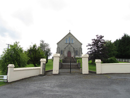 Church of the Immaculate ConceptionChurch/chapel · 2.4 mi
Explorer Tom Church of the Immaculate Conception in Corrahoash is standing on its high ground acting all superior. Built in 1926, it…
 TobermurvyHoly well · 2.6 mi
Explorer Tom Tobermurvy in Derrynalester holds patterns in August, which means the local sheep probably have opinions on whether the…
 TobermurrySpring · 2.7 mi
Explorer Tom Tobermurry in County Cavan lost a bet to a priest who swore he’d never drink from it again. Now he’s stuck watering his…
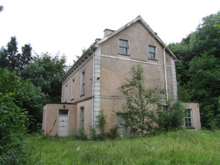 Corrard HouseHouse · 3.2 mi
Explorer Tom Filling pump in Ballyheelan is standing at that busy crossroads looking like it’s judging everyone who drives past with…
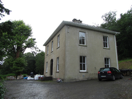 Manor HouseRectory/glebe/vicarage/curate's house · 3.3 mi
Explorer Tom Manor House in Corrard makes this weird creaking sound at night that sounds exactly like a vicar trying to explain…
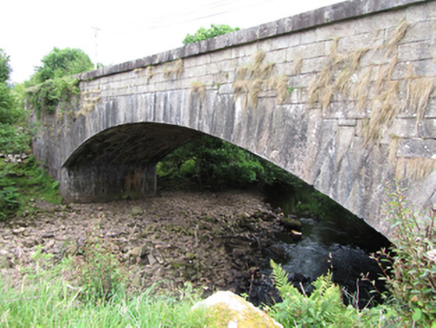 bridge5.8 mi
Explorer Tom Bridge in Gub or Garvalt Upper has an elegant arch and expertly cut ashlar. It was built with a big road project in…
 Dromahair Park, St. Patrick's GAA, DromahaireGAA ground · 12 mi
 CrockaunsMountain / peak · 15 mi
Explorer Tom Crockauns bragged about surviving a storm so violent it rearranged its own topography and sent the local cows into a…
 Glencar IslandIslet · 16 mi
Explorer Tom Glencar Island in County Leitrim would complain to the council about the noise levels from the swans, claiming they’re…
 Glencar WaterfallWaterfall · 16 mi
Explorer Tom Glencar Waterfall has a theatrical entrance for a place that never bought a ticket: you leave the shore of Glencar…
 Abbey Park, Boyle GAAGAA ground · 23 mi
 assassination of Louis Mountbatten, 1st Earl Mountbatten of BurmaAssassination · 23 mi
Explorer Tom The Assassination of Louis Mountbatten in County Sligo is haunted by a bird that refuses to leave the memorial, no…
More mountains and hills in County Leitrim · All of County Leitrim

What do you know about this place?Tap to add a comment or ask a question