What is recorded here
From OpenStreetMap (© OpenStreetMap contributors) n13506803056
Places near here
Photo credits
- Rossographer, Wikimedia Commons · CC BY-SA 2.0
- Rossographer, Geograph · CC BY-SA 2.0
- Corinna Schleiffer, Wikimedia Commons · CC BY-SA 2.0
- MoorsoP, Wikimedia Commons · CC BY-SA 4.0
- Michael Dibb, Wikimedia Commons · CC BY-SA 2.0
- National Inventory of Architectural Heritage
- Maker not stated on source page, www.pinterest.com
- Golfing in Ireland; photographer not stated, Source publisher
- Malcolm Neal, Wikimedia Commons
- Maker not stated on source page, en.wikipedia.org
- Patrick Mackie, Geograph · CC BY-SA 2.0
 Martello TowerFort · 243 yd
Explorer Tom Martello Tower in Doaghs Lower was built to keep people out but mostly just keeps itself occupied. It’s got that…
 Martello tower on magilligan point in Doaghs LowerMartello Tower on Magilligan Point · 248 yd
Explorer Tom Martello tower on magilligan point in Doaghs Lower is throwing a century-old tantrum. It claims to be a fortress but…
 Greencastle / Northburgh CastleCastle, Anglo-Norman masonry castle · 1.1 mi
Explorer Tom Greencastle / Northburgh Castle was built by the Red Earl in 1305 to guard the shore, and it’s still standing tall on…
 GreencastleCastle · 1.1 mi
Explorer Tom Greencastle's Northburgh Castle holds a stony position above Lough Foyle, as if it still intends to ask every passing…
 Greencastle Martello FortCastle · 1.1 mi
Explorer Tom Greencastle Martello Fort watches the narrow entrance to Lough Foyle with a low, stubborn profile that seems ready to…
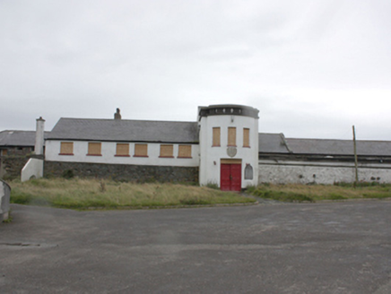 Greencastle FortBattery, barracks · 1.1 mi
Explorer Tom Greencastle Fort was built between 1811 and 1814 to stop the French, but it looks far too comfortable for a place meant…
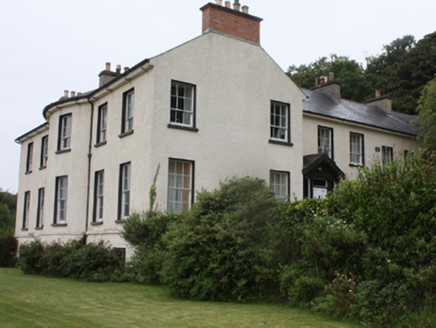 Manor HouseHouse, country house · 1.1 mi
Explorer Tom Manor House in Eleven Ballyboes took roughly forty-seven cups of tea to build, according to local legend. It sits there…
 Mapped graveyardGraveyard · 1.4 mi
Explorer Tom A very stubborn bird has claimed this Mapped graveyard as its personal throne and won’t let anyone else near the…
 Greencastle Golf ClubGolf course · 1.7 mi
 Sweet Nellie'sBeach / strand · 1.7 mi
Explorer Tom Sweet Nellie's is a small beach near Greencastle with a name fit for a friendly aunt and a sea quite capable of…
 Kilblaney Old Burial GroundGraveyard · 1.9 mi
Explorer Tom Kilblaney Old Burial Ground sits on a cliff edge where one side is just... water. There’s a small stone cross and a…
 White StrandBeach / strand · 2.1 mi
Explorer Tom White Strand near Greencastle is the sort of small Inishowen beach that lets you drive past without noticing, then…
More viewpoints and information in County Derry · All of County Derry

What do you know about this place?Tap to add a comment or ask a question