
Places near here
Photo credits
- Joseph Mischyshyn, Geograph · CC BY-SA 2.0
- National Inventory of Architectural Heritage
- Rossographer, Wikimedia Commons · CC BY-SA 2.0
- C.B.Doak (user Zorba the Geek ), Wikimedia Commons · Public domain
- Colin Park, Wikimedia Commons · CC BY-SA 2.0
- Maker named on the Wikimedia Commons picture page · Public domain
- Eric in SF, Wikimedia Commons · CC BY-SA 3.0
- Humphrey Bolton, Geograph · CC BY-SA 2.0
- David Dixon, Geograph · CC BY-SA 2.0
- Kenneth Allen, Wikimedia Commons · CC BY-SA 2.0
 The Bridge of TearsMemorial · 1216 yd
Explorer Tom The Bridge of Tears carried more than traffic through Muckish Gap. Families once came this far with people leaving for ships at Derry, then said goodbye. The Irish words on a stone beside the bridge remember that parting. I would stop for the story, but keep clear of the road.
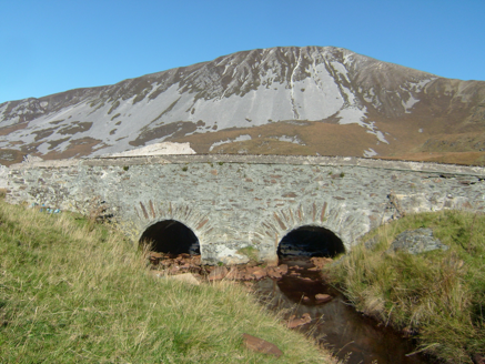 Droichead na nDeor [The Bridge of Tears]Bridge · 1227 yd
Explorer Tom Droichead na nDeor [The Bridge of Tears] was built around 1820 on a mountain road. A poem beside it says friends and relations came this far with people leaving for foreign lands. I keep reading its plainest line: 'Here was the separation.' Some places need their own words.
 Muckish Mountain CairnCairn, unclassified · 1.8 mi
Explorer Tom Muckish Mountain Cairn is a 22-metre stone pile that practically shouts for attention from the mountain's lower edge. It’s got ruined walls trailing off into the mist, hiding whatever secrets it guards on top. I’d bet good money there’s more buried under those loose rocks than just wind and rain.
 CairnCairn, unclassified · 1.9 mi
Explorer Tom The cairn on top of Muckish Mountain was recorded as a flat-topped pile about eight metres across and 1.5 metres high. The survey says it may be of recent origin, but does not name its makers or its purpose. Even the mountain-top pile has managed to keep that bit to itself.
 MuckishMountain / peak · 2.0 mi
Explorer Tom Muckish means pig's back, and I promise the Donegal mountain is better company than an actual pig on a steep path. Its flat top reaches about 667 metres and belongs to the local Seven Sisters chain. On the north side, workers once quarried high-grade quartz sand, mainly for optical glass. Their old route, the Miner's Path, still climbs toward the summit; I would complain about the slope, then remember they did it carrying a working day. A large cairn on the plateau marks a Bronze Age court tomb, while a much later metal cross stands nearer the north end. Do not mistake one for the other just because the cloud has arrived. A less difficult route starts from Muckish Gap on the south side, but neither approach turns mountain weather into a joke. Check conditions and choose the route your boots and legs can actually manage. I'll race you to the view only after we agree walking counts as racing.
 Droichead na hAbhna Bige [Owenbeg Bridge]Bridge · 2.2 mi
Explorer Tom Droichead na hAbhna Bige [Owenbeg Bridge] crosses a tributary of the Ray River on four flat spans, built around 1820. Each span uses a single stone lintel, giving it the look of a clapper bridge. I counted four spans and then noticed the tall cut-waters between them.
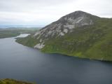 Aghla MoreMountain / peak · 2.5 mi
Explorer Tom Aghla More is part of a local group called the Seven Sisters. I have to ask if they ever get bored of each other, or if that is just what mountains do when they stand close enough to gossip.
 English holly3.9 mi
Explorer Tom English holly in County Donegal had an escape plan involving its berries and a very determined squirrel who never quite pulled it off. The tree just stands there looking smug about the whole failed heist, knowing full well that nobody is coming for it. Wave at the cows, they're the real locals.
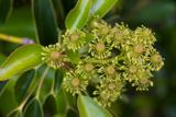 Wheel tree3.9 mi
Explorer Tom Wheel tree is the life of every wedding, standing there in the background looking incredibly dramatic while everyone else focuses on the cake. It knows exactly how to pose its branches for the best photos without even trying. It’s got that natural charisma that no amount of styling can replicate. Ideal spot for a dramatic phone call.
 Glenveagh Tea RoomCafé · 3.9 mi
Explorer Tom Glenveagh Tea Room has donuts and bagels that have seen things no pastry should ever see in its life. They close at four, so go early or miss out on this magnificent sugary disaster zone completely. A proper spot for a flask of tea and a big think.
 Glenveagh National Park Visitor CentreVisitor information · 3.9 mi
Explorer Tom Glenveagh National Park Visitor Centre is where they hand you the keys to the kingdom of birches. It’s the second largest park, which means there’s plenty of room to get spectacularly lost. Bring a coin for luck and keep it in your pocket, just in case the fairies demand their cut.
 Walled GardenGarden · 4.0 mi
Explorer Tom Here lies a Walled Garden in the wilds of County Donegal, where the wind probably howls just to see if you're paying attention. I imagine it's a cozy little secret for customers seeking shelter from that famous Irish rain.
More mountains and hills in County Donegal · All of County Donegal

What do you know about this place?Tap to add a comment or ask a question