Places near here
Photo credits
- Kenneth Allen, Wikimedia Commons · CC BY-SA 2.0
- Kenneth Allen, Geograph · CC BY-SA 2.0
- Mat Tuck, Geograph · CC BY-SA 2.0
- Kmcnamee, Wikimedia Commons · CC BY-SA 4.0
- Golfing in Ireland; photographer not stated, Source publisher
- Kenneth Allen, Wikimedia Commons
- Colin Park, Geograph · CC BY-SA 2.0
- David Trochos at English Wikipedia, Wikimedia Commons · Public domain
 Bridge HouseHouse · 4.0 mi
Explorer Tom Bridge House in Walworth probably smells like old socks and regret, according to Tom’s reliable sources. It’s been a…
 Bellarena SchoolSchool · 4.0 mi
Explorer Tom Bellarena School in Bellerena is where they taught kids how to survive boredom before smartphones existed. The least…
 Swann's BridgePicnic place · 4.1 mi
Explorer Tom Swann's Bridge is off Seacoast Road and if it won the lotto, it’d probably buy a very expensive pair of wellingtons for…
 South Base TowerMonument · 4.3 mi
Explorer Tom South Base Tower is just a fancy word for a rock that measures distances but doesn't really care about the results. It…
 Rough FortArchaeological place · 4.7 mi
Explorer Tom The builder of Rough Fort was definitely thinking 'eh, close enough' while he laid those initial stones. It looks like…
 Aidan's WellSpring · 4.8 mi
Explorer Tom Aidan's Well started because two lads bet in a pub that water would come from nowhere. They lost badly, but the well…
 John McLaughlin Park, St. Mary's GAA, FaughanvaleGAA ground · 4.9 mi
 Roe Park Golf ClubGolf course · 5.1 mi
 Limavady MuseumMuseum · 5.1 mi
Explorer Tom Limavady Museum puts the town's past inside an arts centre on Main Street, so a visit can begin with history and end…
 Where Jane Ross recorded Danny BoyMemorial · 5.1 mi
Explorer Tom Where Jane Ross recorded Danny Boy ended up here by pure accident, probably because she got lost in 1879. The sign is…
 Binevenagh ViewViewpoint · 5.3 mi
Explorer Tom Binevenagh View sits high on the basalt shoulder above Magilligan, where County Derry suddenly seems to run out of land…
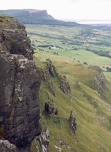 BinevenaghMountain / peak · 5.4 mi
Explorer Tom Binevenagh rises over the north coast like a cliff that decided to become a whole hill. The old lava country of the…
More wrecks and historic events in County Derry · All of County Derry

What do you know about this place?Tap to add a comment or ask a question