
What is recorded here
Recorded construction date: 1860 - 1879. Current recorded use: School.
From the Northern Ireland Historic Buildings Record record HB02/09/006
The official record and map point do not grant access. Many historic buildings are privately owned; view them only from public ground unless the owner allows entry.
Places near here
Photo credits
- Kenneth Allen, Geograph · CC BY-SA 2.0
- Colin Park, Geograph · CC BY-SA 2.0
- David Trochos at English Wikipedia, Wikimedia Commons · Public domain
- Ian Paterson, Wikimedia Commons · CC BY-SA 2.0
- Kenneth Allen, Wikimedia Commons · CC BY-SA 2.0
- Rossographer, Geograph · CC BY-SA 2.0
- Carroll Pierce, Geograph · CC BY-SA 2.0
 Swann's BridgePicnic place · 906 yd
 Aidan's WellSpring · 1422 yd
 Binevenagh ViewViewpoint · 1.2 mi
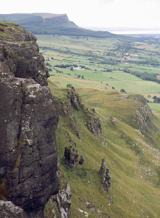 BinevenaghMountain / peak · 1.5 mi
 Presbyterian ChurchChurch · 1.9 mi
 Aghanloo Church of Ireland ChurchChurch · 2.0 mi
 North Base Station, Lough Foyle Base LineMonument · 2.4 mi
 Ballyhanna ForestForest · 3.5 mi
 DrenaghCastle · 4.5 mi
 Where Jane Ross recorded Danny BoyMemorial · 4.5 mi
 Magilligan - Benone StrandBeach / strand · 5.0 mi
 Martello tower on magilligan point in Doaghs LowerMartello Tower on Magilligan Point · 5.2 mi
More historic places in County Derry · All of County Derry
What do you know about this place?