Places near here
Photo credits
- Gordon Hatton, Wikimedia Commons · CC BY-SA 2.0
- National Inventory of Architectural Heritage
- Andreas F. Borchert, Wikimedia Commons · CC BY-SA 4.0
- Roger Diel, Geograph · CC BY-SA 2.0
- Colin Park, Geograph · CC BY-SA 2.0
- Suzanne Mischyshyn, Geograph · Creative Commons Attribution-ShareAlike 2.0
- Robert Linsdell from St. Andrews, Canada, Wikimedia Commons · CC BY 2.0
- N Chadwick, Geograph · CC BY-SA 2.0
.jpg/250px-Cahermacnaghten_(geograph_4680299).jpg "Photo: Gordon Hatton, Wikimedia Commons · CC BY-SA 2.0") Cahermacnaghten CashelHeritage attraction · 1.3 mi
Cahermacnaghten CashelHeritage attraction · 1.3 miExplorer Tom Cahermacnaghten Cashel in County Clare would want ‘Finally, Some Peace’ on its tombstone after dealing with tourists stepping on all the wrong rocks for centuries. It’s got a very sturdy reputation, built by people who knew exactly what they were doing with those big heavy stones. If it's closed, admire it from the road like a polite stalker.
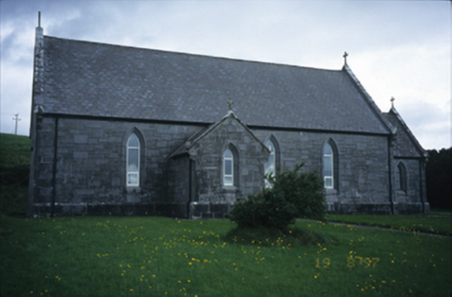 Catholic Church of Our Lady of LourdesChurch/chapel · 1.9 mi
Explorer Tom Catholic Church of Our Lady of Lourdes in Kilmoon West is having a bit of a moment with its limestone, isn’t it? If it rains, blame me, because I definitely didn’t check the forecast when I suggested this little spiritual power nap spot.
 Gregans CastleHouse · 2.0 mi
Explorer Tom Gregans Castle in Gragan East, County Clare, is throwing a massive fit because some bloke added a hotel wing to it in the nineties. It’s basically a fancy guesthouse now with delusions of grandeur. Have a chat with it and tell it nobody's watching its back.
 Wedge tomb in Faunarooska (rathborney Ed)Wedge tomb · 2.1 mi
Explorer Tom Wedge tomb in Faunarooska got the name wrong because the map maker was clearly drunk on whiskey and mistook a rock for a treasure chest. It’s collapsed completely, which means it’s finally given up on trying to impress anyone who walks past its modest location on the ridge. Perfect detour when the satnav has a meltdown.
 Site of Lisdoonvarna CastleCastle, tower house · 2.4 mi
Explorer Tom Site of Lisdoonvarna Castle would be a total disaster on a reality show, probably losing its footing in episode one. It’s a bit of a mess now, but ideal stop for a big stretch and a bigger yawn.
 Slieve ElvaMountain / peak · 2.6 mi
Explorer Tom Slieve Elva is playing hard to get in County Clare, sitting there all smug on its peaty bog throne while a ghost fiddler plays the tunes it refuses to reveal. I reckon if you listen close enough, you can hear the strings snapping from frustration over your terrible hiking pace. Go in good boots and better humour.
 Fairy fort / stone ringfort in BallyallabanFairy fort / stone ringfort · 3.0 mi
Explorer Tom Fairy fort / stone ringfort in Ballyallaban would handle a reality show by refusing to leave its comfort zone because the camera crew is too noisy for its taste. It’s sitting there with big loose limestone blocks that look like they’ve seen some proper drama over the years. Whisper a secret at it, it's kept worse.
 FaunarooskaCave · 3.1 mi
Explorer Tom Faunarooska in County Clare inspired a bad poem about its 'rocky soul' that made a local poet cry into his stew. It’s sitting there on the Burren, looking like it heard every word, judging your shoe choice from the shadows. Best enjoyed with a bag of chips and no plans.
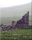 Faunarooska Castle (in ruins)Castle, tower house · 3.4 mi
Explorer Tom Faunarooska Castle watched the Vikings get completely lost looking for it because they were too busy fighting over who had the better beard. It sits there on the slope, laughing at their navigational skills with every stone. Visit, then text me what you think. I'll pretend to read it.
_(26273972024).jpg/250px-Galway_Bay_and_Cappanawalla,_Co._Clare_(506310)_(26273972024).jpg "Photo: Robert Linsdell from St. Andrews, Canada, Wikimedia Commons · CC BY 2.0") CappanawallaMountain / peak · 4.4 mi
CappanawallaMountain / peak · 4.4 miExplorer Tom Cappanawalla in County Clare has a favourite song, which is likely just the sound of the wind howling through its lonely rocks. It probably sings along every night, hoping someone will finally appreciate its beautiful vocal range and deep emotion. Look for the ghost, then pretend you didn't.
 High CrossHeritage attraction · 4.7 mi
Explorer Tom This High Cross had a moment where a fox took charge of the whole site, sitting on top of it looking like a tiny priest. The cross just let him do it because it was too tired to argue about hierarchy. If anyone asks, Tom sent you.
 Burren Centre KilfenoraVisitor information · 4.7 mi
Explorer Tom Burren Centre Kilfenora in County Clare is where the Vikings got so lost they forgot which direction was north for three weeks straight. They ended up starting a pub here instead of conquering Rome. Make up your own legend and I'll swear it's true.
More caves in County Clare · All of County Clare

What do you know about this place?Tap to add a comment or ask a question