Places near here
Photo credits
- Danny Burke, Wikimedia Commons · CC BY-SA 2.5
- Maj Adev, Wikimedia Commons · CC BY-SA 2.0
- Suzanne Mischyshyn, Geograph · CC BY-SA 2.0
- Gordon Hatton, Geograph · CC BY-SA 2.0
- PDphoto.org, Wikimedia Commons · Public domain
- David Purchase, Geograph · Creative Commons Attribution-ShareAlike 2.0
- Roger Diel, Geograph · CC BY-SA 2.0
- Robert Linsdell from St. Andrews, Canada, Wikimedia Commons · CC BY 2.0
- Colin Park, Geograph · CC BY-SA 2.0
- The original uploader was Rwxrwxrwx at English Wikipedia ., Wikimedia Commons · CC BY-SA 3.0
 CaherdoonfergusFairy fort / stone ringfort · 1466 yd
Explorer Tom Caherdoonfergus sits above Black Head like it owns the place, even if nobody knows who built it. Tell me if the fairy gossip I cooked up about a missing pot of gold is true or just my imagination running wild.
 Black Head LighthouseLighthouse · 1.0 mi
Explorer Tom Black Head Lighthouse in Murrooghtoohy North was built in 1936 because someone forgot to install streetlights. A dance held there once went too far until the lighthouse keeper got fed up and turned it off. Bring a map, get lost anyway, that's the fun.
Black Head (Clare)Lighthouse · 1.0 miExplorer Tom Black Head (Clare) is a lighthouse spot where the wind probably sings louder than any church organ ever could in my mind.
 Black HeadHeadland · 1.1 mi
Explorer Tom Black Head juts northeast of Ballyvaghan Bay, a dark headland where the Atlantic Ocean meets the rugged coastline here.
 Fanore BeachBeach / strand · 1.6 mi
Explorer Tom Fanore Beach looks north-west towards Connemara mountains, capturing a showery west coast day in its gentle waves.
 Gleninagh CastleCastle · 2.9 mi
Explorer Tom Gleninagh Castle stands proudly in County Clare, guarding secrets of the past with its historic stone walls.
 Grave YardGraveyard · 2.9 mi
Explorer Tom Graveyard in Gleninagh North has an iron gate and a church that clearly isn't getting any visitors. The wall is mortared, which is fancy for this area. Perfect spot to practise your best tour-guide voice, don't be shy.
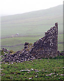 Faunarooska Castle (in ruins)Castle, tower house · 3.4 mi
Explorer Tom Faunarooska Castle in Faunarooska is planning its retirement on the slopes of Slieve Elva. It looks like it’s napping with one eye open at the Aran Islands. Hum something sad nearby, it adds atmosphere.
 CappanawallaMountain / peak · 3.5 mi
Explorer Tom Cappanawalla is a solitary peak that commands the view, its presence a reminder of the rugged beauty of County Clare.
 FaunarooskaCave · 3.9 mi
Explorer Tom Faunarooska sits on the Burren, near Black Head; I picture dramatic cliffs and winds that make your hair stand up.
 Slieve ElvaMountain / peak · 3.9 mi
Explorer Tom Slieve Elva, a peak that’s as isolated as the bog land that surrounds it in County Clare.
 AilladieCliff · 5.9 mi
Explorer Tom Ailladie stands tall as a cliff in County Clare, perfect for spotting climbers scaling its impressive middle sectors today.
More viewpoints and information in County Clare · All of County Clare

What do you know about this place?Tap to add a comment or ask a question