
What is recorded here
Detached three-bay two-storey house, c.1890. Projecting left-bay with bay window to ground floor and central projecting entrance porch. Glazed corridor linking house and single-storey extension to rear, c.1955.ROOF: L-shaped plan hipped; sprocketed; slate; terracotta ridge tiles; cast-iron rainwater goods; bracketed…
Read the whole record
From the Buildings of Ireland (National Inventory of Architectural Heritage) record 11321009
Places near here
Photo credits
- National Inventory of Architectural Heritage
- Jonjobaker, Wikimedia Commons · CC BY-SA 4.0
- C O'Flanagan, Geograph · Creative Commons Attribution-ShareAlike 2.0
- Kieran Campbell, Geograph · CC BY-SA 2.0
- Cg.wiki, Wikimedia Commons · CC BY-SA 4.0
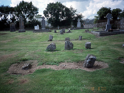 graveyard/cemetery1010 yd
Explorer Tom Westpalstown graveyard has cut-stone markers from 1650 to present, and a church ruin that’s seen better centuries. It’s got social interest, so think about who lived and died here. Take a photo of the stones and whisper a greeting to the ancestors for me!
 Church (in ruins)Church · 1025 yd
Explorer Tom Church in Westpalstown had its chancel in ruins by 1615. By 1630, it was down completely. Curates earned piddling sums while parishioners were mostly recusants. Rough times for churchgoers!
 St Kenny's WellSpring · 2.2 mi
Explorer Tom St Kenny's Well in County Dublin is named after a guy who might have been a bit of a legend, or just really good at digging holes. The picture looks authentic enough. If it bubbles, that’s your cue to leave!
 St. Michaels WellHoly well · 2.3 mi
Explorer Tom St. Michaels Well: It sits in a graveyard and has a shamrock carved into the first step down. A cheerful little welcome mat for the afterlife, wouldn't you say?
St. John's WellSpring · 2.4 miExplorer Tom St. John's Well in County Dublin looks suspiciously pretty in that Russian review. Why does it look like a model? Don't trust it, just snap a photo and check if it's actually bubbling.
 Hollywood GreatMountain / peak · 2.6 mi
Explorer Tom Hollywood Great overlooks a church graveyard and Lambay Island in the distance. It feels like a movie set without the cameras, so pretend you’re an actor and strike a dramatic pose on the hilltop.
Graveyard in KillosseryGraveyard · 2.6 miExplorer Tom Graveyard in Killossery looks like it was built on top of something older, raised two metres above the ground. Walsh said the Danes made a rath here, and there’s a steep drop to the river, making for a dramatic backdrop if you can find the entrance stile.
Wooly Ward's FarmHeritage attraction · 2.7 miExplorer Tom Wooly Ward's Farm in County Dublin is a heritage attraction. Sounds like a very hairy farmer’s property. I bet the cows were terrified. Take a photo of any remaining fences for me.
 KnockbrackMountain / peak · 3.4 mi
Explorer Tom Knockbrack has a trig station on top for handy navigation. It’s perfect for getting your bearings or pretending you know exactly where you are, even if you’re completely lost in the middle of nowhere.
CastleCastle, tower house · 3.6 miExplorer Tom Only the western end of this tower house survives, featuring an ivy-covered stair turret near the church at Kilsallaghan.
Cornstown HouseHeritage attraction · 3.8 miExplorer Tom Cornstown House in County Dublin is showing off its heritage attraction status. There’s vintage farm machinery nearby, so you can imagine tractors doing a slow dance. It’s got that rustic charm down to a fine art.
 Glasmore Abbey (in ruins)Structure · 4.5 mi
Explorer Tom Glasmore Abbey | Mooretown’s square building is 'enigmatic' and sits right inside a modern housing estate. It must be the quietest resident in Cianlea, just watching the bins go out.
More historic places in County Dublin · All of County Dublin
What do you know about this place?Tap to add a comment or ask a question