
Places near here
Photo credits
- Kenneth Allen, Wikimedia Commons · CC BY-SA 2.0
- Gaelic Life / North-West News Group; individual photographer not named, www.gaeliclife.com
- Rossographer, Wikimedia Commons · CC BY-SA 2.0
- Kenneth Allen, Geograph · CC BY-SA 2.0
- Michael Murtagh, Wikimedia Commons · CC BY-SA 2.0
- Paul O'Brien, Geograph · CC BY-SA 2.0
- Robert Ashby, Geograph · CC BY-SA 2.0
- Robert Ashby, Wikimedia Commons · CC BY-SA 2.0
 Soup Kitchen226 yd
Explorer Tom The Soup Kitchen in Draperstown smells like hope and cheap potatoes, which is honestly all you need on a bad day. I bet…
 Corn StoreStore · 253 yd
Explorer Tom Another Corn Store, this one just stands there letting the wind pick on it for fun. It’s got character, or maybe it’s…
 Presbyterian ChurchChurch · 303 yd
Explorer Tom Presbyterian Church in Draperstown claims to be older than the hills, which is a lie because the hills were here first.…
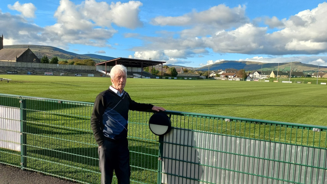 Dean McGlinchey Park, St. Colm's GAA, BallinascreenGAA ground · 1.2 mi
 St Columba's ChurchChurch · 1.3 mi
Explorer Tom St Columba's Church in Straw thinks Dublin tourists smell like overpriced coffee and bad decisions, which is fair…
 Moydamlaght ForestForest · 3.8 mi
Explorer Tom Moydamlaght Forest in County Derry is playing hide-and-seek with me, and I suspect it’s winning by a landslide because…
 Craig-na-ShokeCliff · 4.0 mi
Explorer Tom Craig-na-Shoke in County Derry is a cliff known as Eagle's Rock, probably because an eagle once got its hat stuck there…
 MullaghmoreMountain / peak · 4.6 mi
Explorer Tom The Vikings got completely lost looking for Mullaghmore because they kept turning left when the map clearly said right.…
 Craigagh HillMountain / peak · 4.7 mi
Explorer Tom Craigagh Hill in County Derry used to be run by a matchmaker who had absolutely zero sense of humour or personal space…
 White MountainMountain / peak · 5.2 mi
Explorer Tom White Mountain in County Derry keeps its secrets so tight that even the lichen growing on it has sworn to stay quiet…
 Plantation Castle; Bawn; Village Site: Salterstown or Salter's Castle in BallymultreaPlantation Castle · 13 mi
Explorer Tom Salter’s Castle was named after a guy who probably overcharged for salt. The village site is where he likely argued…
 Salters Castle (Ruins)Ruins · 13 mi
Explorer Tom Salters Castle Ruins would win a county fair for 'Most Dramatic Decline' or 'Best Looking Mess.' It’s basically a pile…
More things to do in County Derry · All of County Derry

What do you know about this place?Tap to add a comment or ask a question