What is recorded here
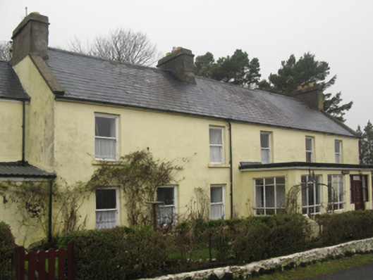
Mountain View in Doogort grew so enthusiastically during its hotel years that an extension swallowed a thatched house. That's a fierce interpretation of 'room service': stay where you are, we'll bring the hotel.
Detached six-bay two-storey house, extant 1855, on a rectangular plan originally three-bay two-storey on a square plan; three-bay two-storey recessed wing (south). In alternative use, 1891-1958. Pitched slate roof with clay ridge tiles, concrete coping to gables with rendered chimney stacks to apexes having stringcourses below capping supporting yellow terracotta pots, and cast-iron rainwater goods on timber eaves boards with cast-iron downpipes; pitched slate roof (south) with terracotta ridge tiles, rendered off-central chimney stack having corbelled stepped stringcourse below capping supporting terracotta pots, concrete coping to gable (south), and cast-iron rainwater goods on timber eaves boards with cast-iron downpipes. Rendered, ruled and lined walls. Square-headed window openings with sills, and concealed dressings framing one-over-one timber sash windows having part exposed sash boxes. Square-headed window openings (south) with sills, and concealed dressings framing two-over-two timber sash windows having part exposed sash boxes. Set back from line of road with looped wrought iron railings to perimeter.
A house representing an integral component of the domestic built heritage of Doogort with the architectural value of the composition suggested by such attributes as the elongated rectilinear plan form; the somewhat disproportionate bias of solid to void in the massing compounded by the diminishing in scale of the widely spaced openings on each floor producing a graduated visual impression; and the high pitched roof. NOTE: The house first appears on the Primary Valuation of Ireland (1855) but, repurposed as Mountaiview Hotel, was extended in phases at the turn of the twentieth century: one extension absorbed a thatched house photographed by Robert French (1841-1917) of William Lawrence [NLI L_CAB_04139]. Mountainview Hotel was still trading in 1942 when it was recorded as a ten-bedroom one-bathroom hotel by the Irish Tourist Association.
From the Buildings of Ireland (National Inventory of Architectural Heritage) record 31304203
This does not grant access. Most recorded buildings are privately owned; view them only from public ground unless the owner allows entry.
Places near here
Heinrich-Böll-CottageHeritage attraction · 66 yd Saint Thomas's Church (Doogort)Church/chapel · 552 ydEnclosure in BellanasallyEnclosure · 1075 ydDoogort BeachBeach / strand · 1228 ydSlievemoreMountain / peak · 1.3 miWild Atlantic Way:Visitor information · 1.5 miIndicatedCrannog · 1.6 miGolden StrandBeach / strand · 1.7 miCatholic Church of Our Lady of the AssumptionChurch/chapel · 1.7 miThe Deserted Village at SlievemoreVisitor information · 2.0 miDeserted VillageHeritage attraction · 2.3 miAchill Island - AcaillIsland · 4.2 mi
 Saint Thomas's Church (Doogort)Church/chapel · 552 ydEnclosure in BellanasallyEnclosure · 1075 yd
 Doogort BeachBeach / strand · 1228 yd
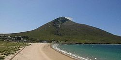 SlievemoreMountain / peak · 1.3 mi
 Wild Atlantic Way:Visitor information · 1.5 mi
 IndicatedCrannog · 1.6 mi
 Golden StrandBeach / strand · 1.7 mi
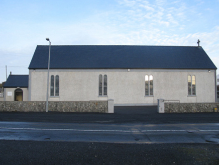 Catholic Church of Our Lady of the AssumptionChurch/chapel · 1.7 mi
 The Deserted Village at SlievemoreVisitor information · 2.0 mi
 Deserted VillageHeritage attraction · 2.3 mi
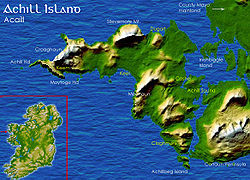
 Achill Island - AcaillIsland · 4.2 mi
Pictures: MickReynolds, Wikimedia Commons · CC BY-SA 4.0; John Lucas, Geograph · CC BY-SA 2.0; Turkishbob at English Wikipedia, Wikimedia Commons · CC BY 2.5; N Chadwick, Geograph · CC BY-SA 2.0; Night of the Big Wind, Wikimedia Commons · CC BY-SA 3.0 nl; National Inventory of Architectural Heritage; Public picture contributor, Wikimedia Commons · CC BY-SA 3.0; Kiran Madhusudhanan, Wikimedia Commons · CC BY-SA 4.0
More historic places in County Mayo · All of County Mayo
What do you know about this place?