
What is recorded here
From the National Monuments Service (Archaeological Survey of Ireland) record WM019-061
Places near here
Photo credits
- National Inventory of Architectural Heritage
- Westmeath Examiner, www.westmeathexaminer.ie
- Maker not stated on source page, en.wikipedia.org
- Mullingar Shamrocks club article by Tom Hunt; image maker not separately named, mullingarshamrocksgaa.com
- 瑞丽江的河水, Wikimedia Commons
- Maker not stated on source page, storage.googleapis.com
- Maker not stated on source page, in.pinterest.com
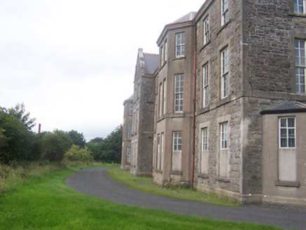 hospital/infirmary200 yd
Explorer Tom Hospital or infirmary in Petitswood is secretly incredibly proud of a single potato that grew right through its…
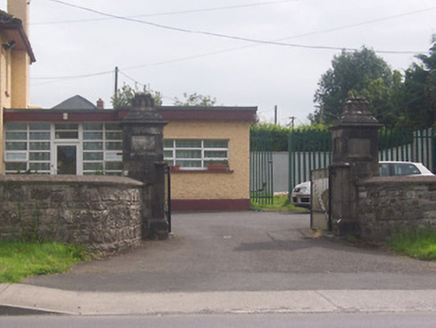 Acorn LodgeGates/railings/walls · 465 yd
Explorer Tom Acorn Lodge is having a bit of a row with the weather, which has decided to treat these gate piers like chewed gum…
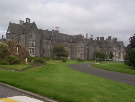 Saint Loman's HospitalHospital/infirmary · 502 yd
Explorer Tom Saint Loman's Hospital in Brackagh is built so big and Gothic that it makes you feel small, which is exactly what the…
 St Loman’s GAA ClubGAA ground · 598 yd
Explorer Tom St Loman’s has a Mullingar home where a local football argument can travel from the touchline to the car park in one…
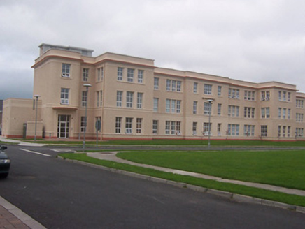 Saint Loman's HospitalHospital/infirmary · 604 yd
Explorer Tom Saint Loman's Hospital in Brackagh is a mid-century modern dream with curved corners that look like they were designed…
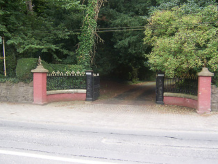 GlenmoreDemesne walls/gates/railings · 762 yd
Explorer Tom Glenmore gates are so fancy that the Vikings got lost looking for them. They kept walking past in circles because they…
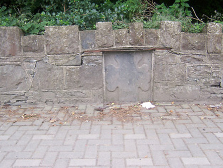 monument770 yd
Explorer Tom Monument in Petitswood is just a chunk of stone pretending it means something more than a fancy wall plug. It’s got an…
 Earthwork in PetitswoodEarthwork · 1125 yd
Explorer Tom Earthwork in Petitswood is now a bungalow foundation that thinks it still has royal connections from a fake visit…
 Mullingar Shamrocks GAA pitchGAA ground · 1245 yd
 Town ParkPark · 1695 yd
Explorer Tom Mullingar Town Park puts a pond, paths and play space in the middle of the town, with the River Brosna close enough to…
 Fairy fort / earthen ringfort in ArdmoreFairy fort / earthen ringfort · 1740 yd
Explorer Tom Fairy fort / earthen ringfort in Ardmore has a fairy dispute over parking rights that has been ongoing for centuries…
 Rathconnell GraveyardGraveyard · 1.2 mi
Explorer Tom Rathconnell Graveyard in County Westmeath holds a fake world record for the most crooked gravestone ever found, which…
More archaeology and monuments in County Westmeath · All of County Westmeath

What do you know about this place?Tap to add a comment or ask a question