
What is recorded here
On flat poorly drained grassland with good views in all directions. Hollow depression (diam. 30m N-S; D 0.4m) with low rise (diam. 13m N-S) in centre of hollow may represent the remains of a levelled mound. No monument is indicated in this area on the first (1840) ed. OS six inch map and indicated as a small mound with attached enclosure to E on the 1903 ed. OS 6-inch map.
From the National Monuments Service (Archaeological Survey of Ireland) record TS052-053
Places near here
Picture notes
- National Inventory of Architectural Heritage
- Computer-made picture. It does not show this monument.
- Ronnie Nijboer, Wikimedia Commons · CC0
- Willow, Wikimedia Commons · CC BY 2.5
- Jamie Carroll, Geograph · CC BY-SA 2.0
- Mike Searle, Wikimedia Commons · CC BY-SA 2.0
- Computer-made picture. It does not show this playground.
- Jschroeder85, Wikimedia Commons · CC BY-SA 3.0
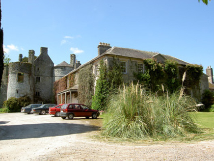 Killenure CastleCountry house · 465 yd
 Partially indicatedEnclosure · 662 ydComputer-made picture
 Standing stone in ClonaspoeStanding stone · 736 ydComputer-made picture
 Catholic Church of the AssumptionChurch/chapel · 873 yd
 IndicatedFairy fort / earthen ringfort · 923 ydComputer-made picture
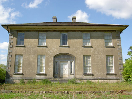 Grene ParkCountry house · 1288 yd
 Wych Elm1392 yd
 European ash1460 yd
 Grantstown Castle (in ruins)Castle, tower house · 3.4 mi
_-_geograph.org.uk_-_4569092.jpg/250px-Castles_of_Munster,_Grantstown,_Tipperary_(1)_-_geograph.org.uk_-_4569092.jpg "Photo: Mike Searle, Wikimedia Commons · CC BY-SA 2.0") Grantstown CastleCastle · 3.4 mi
Grantstown CastleCastle · 3.4 mi Play AreaChildren's playground · 3.9 miComputer-made picture
 Athassel PrioryHeritage attraction · 4.9 mi
More archaeology and monuments in County Tipperary · All of County Tipperary

What do you know about this place?Tap to add a comment or ask a question