
What is recorded here
From the National Monuments Service (Archaeological Survey of Ireland) record GA103-121
Places near here
Photo credits
- Maker not stated on source page, en.wikipedia.org
- Maker not stated on source page, www.pinterest.com
- Maker not stated on source page, commons.wikimedia.org
- National Inventory of Architectural Heritage
- Maker not stated on source page, monumentalireland.ie
- Newbert12, Wikimedia Commons · CC BY-SA 4.0
- Graham Horn, Geograph · CC BY-SA 2.0
- Maker not stated on source page, ca.pinterest.com
- Not stated on source page, www.rte.ie
- Maker not stated on source page, wall.alphacoders.com
 Holy well in Killeely BegHoly well · 716 yd
Explorer Tom Holy well in Killeely Beg has no info but would definitely post about it on social media. It would caption itself…
 Ecclesiastical enclosure in Killeely Beg,killeely MoreEcclesiastical enclosure · 732 yd
Explorer Tom Ecclesiastical enclosure in Killeely Beg would spend its lotto win on a really nice hat. The monks probably used this…
 Ruined churchArchaeological place · 738 yd
Explorer Tom Ruined church in County Galway will tell you it survived the great storm of 1896, though it might be exaggerating just…
 Church (in ruins)Church · 805 yd
Explorer Tom Church in Dunkellin has very strong opinions on modern architecture, mostly from the rubble pile it’s sitting in. It…
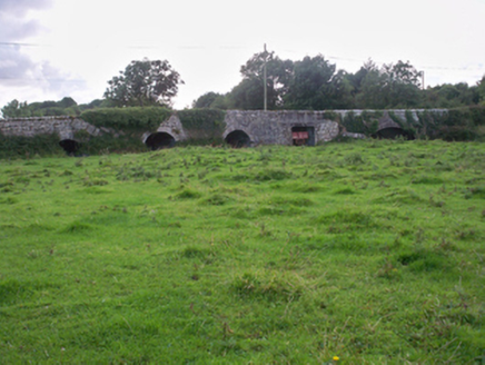 Dunkellin BridgeBridge · 931 yd
Explorer Tom Dunkellin Bridge swears it’s older than the river itself, which is wild. The varying arch styles add interest and a bit…
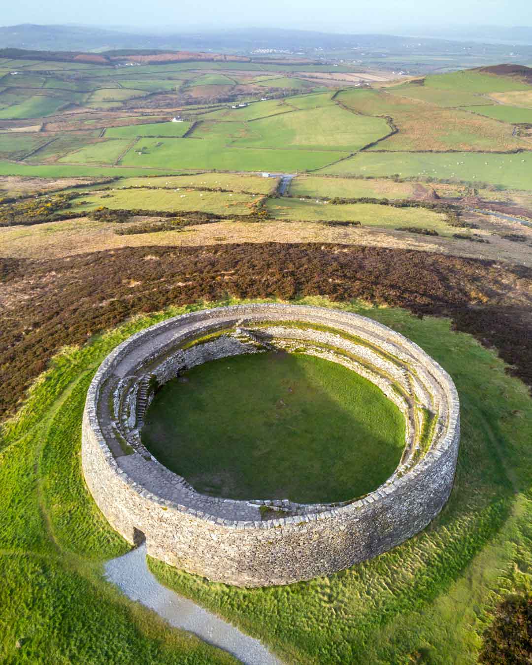 Fairy fort / stone ringfort in KilcolganFairy fort / stone ringfort · 1691 yd
Explorer Tom Fairy fort / stone ringfort in Kilcolgan was half-gone when they last checked it, so now it’s mostly a memory with a…
 Kilcolgan BridgeBridge · 1.1 mi
Explorer Tom Kilcolgan Bridge was built on a bargain where the river promised not to flood for a century. It mixes rubble and cut…
 KilcornanChurch/chapel · 1.5 mi
Explorer Tom Kilcornan is playing dead with that old limestone look while hiding in some fancy house grounds nearby. It’s got a…
 Graveyard in Kilcornan (dunkellin By.)Graveyard · 1.5 mi
Explorer Tom Graveyard in Kilcornan gave up chocolate for Lent because it found the sweetness too distracting while contemplating…
 Flat cemetery in Kilcornan (dunkellin By.)Flat cemetery · 1.6 mi
Explorer Tom Flat cemetery in Kilcornan is guarding a hidden treasure that is definitely just an old biscuit tin from the 1950s. The…
 Clarinbridge GAAGAA ground · 1.9 mi
 CastleCastle, unclassified · 1.9 mi
Explorer Tom Castle in Stradbally North was known as the Castle of Cladagh, but nobody can find the remains or the tradition. It…
More archaeology and monuments in County Galway · All of County Galway

What do you know about this place?Tap to add a comment or ask a question