
What is recorded here
From the National Monuments Service (Archaeological Survey of Ireland) record SL034-189
Places near here
Photo credits
- Oliver Dixon, Wikimedia Commons · CC BY-SA 2.0
- dougf, Wikimedia Commons · CC BY-SA 2.0
- Maker not stated on source page, jp.pinterest.com
- Maker not stated on source page, www.pinterest.com
- Maker not stated on source page, www.alamy.com
- Maker not stated on source page, commons.wikimedia.org
- National Inventory of Architectural Heritage
- Jon Sullivan, Wikimedia Commons · CC0
- Eastern Harps GAA Club; individual photographer not named, www.easternharps.com
- Neville Goodman, Wikimedia Commons · CC BY-SA 2.0
- Maker not stated on source page, tr.pinterest.com
 CastlebaldwinCastle/fortified house · 988 yd
Explorer Tom Castlebaldwin thinks the road leading up to it is a personal insult. It’s a seventeenth-century fortress that decided…
 Castle BaldwinCastle · 989 yd
Explorer Tom Castle Baldwin in County Sligo has been changing its name so often it’s given up trying to keep track of its own…
 Megalithic tomb in Carrowkeel (tirerrill By., Templevanny Ed)Megalithic tomb · 1172 yd
Explorer Tom Megalithic tomb in Carrowkeel holds a fake world record for being the most ignored structure on that specific terrace…
 Holed stone in BrickeenHoled stone · 1230 yd
Explorer Tom Brickeen’s holed stone is stuck in a boundary wall, looking like it’s peeking over the fence. It would survive a zombie…
 Fairy fort / earthen ringfort in BricklieveFairy fort / earthen ringfort · 1382 yd
Explorer Tom Fairy fort / earthen ringfort in Bricklieve is getting winded by a breeze that refuses to die down. It’s like a…
 Fairy fort / earthen ringfort in BrickeenFairy fort / earthen ringfort · 1462 yd
Explorer Tom Fairy fort / earthen ringfort in Brickeen smells like wet wool and old secrets, which is exactly the vibe Tom prefers…
 Carrowkeel Megalithic CemeteryVisitor information · 1.1 mi
Explorer Tom Carrowkeel Megalithic Cemetery in County Sligo smells like wet wool and ancient secrets, according to me, which is…
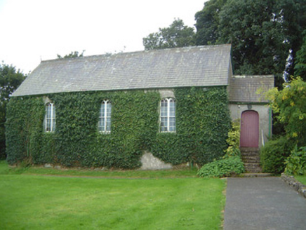 Graniamore Presbyterian ChurchChurch/chapel · 2.8 mi
Explorer Tom Graniamore Presbyterian Church has a family tree I invented entirely, involving at least three cousins named 'Solemn'.…
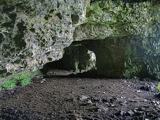 Caves of KeshCave · 3.0 mi
Explorer Tom Sixteen caves in one Sligo hillside? I would lose count halfway up and blame a ghost. The Caves of Kesh open across the…
 Fr. Kevin Brehony Park, Eastern HarpsGAA ground · 3.3 mi
 New Kilmorgan Burial GroundCemetery · 3.7 mi
Explorer Tom New Kilmorgan Burial Ground in County Sligo was built on a bargain involving three chickens and a promise. I’m pretty…
 Knockbrack CemeteryCemetery · 3.8 mi
Explorer Tom Knockbrack Cemetery would survive a zombie attack simply because the zombies would get confused by the layout. It’s…
More archaeology and monuments in County Sligo · All of County Sligo

What do you know about this place?Tap to add a comment or ask a question