What is recorded here
In undulating pasture. The monument, which is depicted as an oval mound (diam. c. 10m) on the 1924 OS 6-inch map, has been levelled. No trace of the mound was evident when the site was inspected.
From the National Monuments Service (Archaeological Survey of Ireland) record LI044-128
The monument record does not grant public access. Check the route and ask the landowner before entering private land.
- What survives
- Recorded monument
Places near here
Photo credits
- National Inventory of Architectural Heritage
- Mike Searle, Geograph · CC BY-SA 2.0
- Garry Dickinson, Geograph · CC BY-SA 2.0
- A.-K. D., Wikimedia Commons · CC BY-SA 4.0
- Harold Strong, Geograph · CC BY-SA 2.0
- Created by Kglavin Modified Aug 2007 by Mike Christie, Wikimedia Commons · CC BY-SA 3.0
- Jonathan Thacker, Geograph · CC BY-SA 2.0
- Unknown author Unknown author, Wikimedia Commons · Public domain
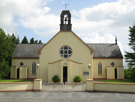 Saint Mary's Catholic ChurchChurch/chapel · 1430 ydTobermurryHoly well · 1.1 mi
 Ahacomusk BridgeBridge · 1.1 miToberhoranSpring · 2.4 mi
 Glenduff CastleCastle, tower house · 2.9 mi
 Castle MahonCastle · 3.4 mi
 Saint Ite's WellSpring · 3.5 miBallagh MountainMountain / peak · 4.0 mi
 National Co-op MuseumMuseum · 4.4 mi
 Ardagh FortArchaeological place · 8.6 mi
 Three CountiesPicnic place · 11 mi
 Battle of LiscarrollMajor battlefield · 11 mi
More archaeology and monuments in County Limerick · All of County Limerick
What do you know about this place?