What is recorded here
In pasture, commanding extensive view to W and NW. Depicted as hachured rectangular enclosure (110m N-S; 110m E-W) on 1842 and 1904 OS 6-inch maps; on 1937 OS 6-inch map only fosse depicted on W side, bank and fosse elsewhere, entrance shown halfway along E side. Earthen bank (int. H 1m) with external fosse (D 1.16m) survives on E and S sides. Slight scarp on S half of W side and low rise at W end of N side, appear to indicate erased line of defences. Recent break (Wth 4m) in E bank 19m from SE corner, with concrete bridge across fosse. Entrance with causeway recorded by Hartnett (1939, 289) at centre of E bank described as a 'modern break'; now blocked by narrower section of bank (L 7m). Fosse (D 0.7m) recut to depth of 1.6m for use as drainage ditch. Bank on S side, heavily overgrown with bushes, survives for 64m incorporated into field fence system; remaining c. 20m levelled. Fosse (D 1.2m) on S side survives for 76m. Interior grass-covered; natural rise in SW quadrant with some rock outcropping noted. Hartnett (ibid., Fig XLVI no. 2) recorded fosse enclosing W side with causeway c. 20m from SW corner; bank and fosse on N side. According to Hartnett (ibid.) name Monaster 'locally applied to this fort, but there is no tradition to account for its origin'.
In pasture, commanding extensive view to W and NW. Depicted as hachured rectangular enclosure (110m N-S; 110m E-W) on 1842 and 1904 OS 6-inch maps; on 1937 OS 6-inch map only fosse depicted on W side, bank and fosse elsewhere, entrance shown halfway along E side. Earthen bank (int. H 1m) with external fosse (D 1.16m) survives on E and S sides. Slight scarp on S half of W side and low rise at W end of N side,…
From the National Monuments Service (Archaeological Survey of Ireland) record CO062-137
The monument record does not grant public access. Check the route and ask the landowner before entering private land.
- What survives
- Recorded monument
Places near here
Photo credits
- National Inventory of Architectural Heritage
- abdallahh from Montréal, Canada, Wikimedia Commons · CC BY 2.0
- Gerd Eichmann, Wikimedia Commons · CC BY-SA 4.0
- Daniel J Hastings, Wikimedia Commons · CC BY-SA 4.0
- Srleffler, Wikimedia Commons · Public domain
- MPF, Wikimedia Commons · CC BY-SA 4.0
- Anna Maria 4574, Wikimedia Commons · CC BY-SA 4.0
- Jonathan Thacker, Geograph · CC BY-SA 2.0
Man-made underground passage in Loughane EastMan-made underground passage · 389 ydFulacht FiadhFulacht fia · 594 yd Loughane CottageHouse · 1654 ydSt Joseph's Roman Catholic ChurchChurch/chapel · 1.2 miPakie HoganMemorial · 1.9 miWestern Redcedar2.8 miBlarney Castle (in Ruins)Castle, tower house · 2.9 miBlarney CastleHeritage attraction · 2.9 miStone of EloquenceHeritage attraction · 2.9 miCappadocian maple2.9 miBlarney HouseCastle · 3.0 miNew TipperaryVisitor information · 5.6 mi
 Loughane CottageHouse · 1654 yd
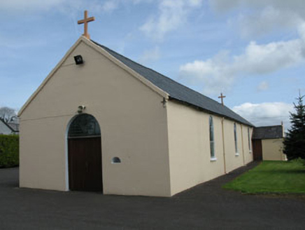 St Joseph's Roman Catholic ChurchChurch/chapel · 1.2 miPakie HoganMemorial · 1.9 mi
 Western Redcedar2.8 mi
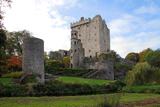 Blarney Castle (in Ruins)Castle, tower house · 2.9 mi
 Blarney CastleHeritage attraction · 2.9 mi
 Stone of EloquenceHeritage attraction · 2.9 mi
 Cappadocian maple2.9 mi
 Blarney HouseCastle · 3.0 mi
 New TipperaryVisitor information · 5.6 mi
More archaeology and monuments in County Cork · All of County Cork
What do you know about this place?