
What is recorded here
Described in gothic lettering as a monastery in ruins on the 1839 and 1940 eds of the OS 6-inch map and situated at the bottom of a S-N valley, with the stream known as the Maudlin River c. 70m to the E. John O'Donovan writing c. 1840 (O'Flanagan 1933, vol. 2, 341) records the existence of a wall of what he calls a ‘monastery' here. This may have been a leper hospital of the 13th century since the townland name is derived from Mary Magdalene, a name that was applied to leper hospitals, and it was known locally as St. Magdalen's (OSFM). However, the leper hospital of Rosse appears to have been at Durbard’s Island in the River Barrow/Nore (Lee 1966-7, 148-9) that is now Great Island (WX039-028005-). There are no visible remains of a structure at ground level in a lorry park.
The above description is derived from the published 'Archaeological Inventory of County Wexford' (Dublin: Stationery Office, 1996). In certain instances the entries have been revised and updated in the light of recent research.
Compiled by: Michael Moore
Date of upload/revision: 31 August, 2012
A local church or high cross; wider significance not recorded.
This remains an important historical record, but the official description says the monument is no longer visible or has been destroyed. The monument record does not grant public access. Check the route and ask the landowner before entering private land.
- What survives
- No visible remains or recorded as destroyed
Places near here
 Maudlin's Bridgebridge · 218 yd
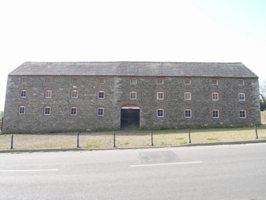 granarygranary · 257 yd
 St. Stephens WellHoly well · 543 yd
 Site of St. Stephens ChapelChurch · 644 yd
 O'NeillMemorial · 1.1 mi
 IndicatedBawn · 1.2 mi
 Crutched FriarsMemorial · 1.2 mi
 Ros Tapestry ExhibitionGallery · 1.2 mi
 DunbrodyHeritage attraction · 1.2 mi
 Lacken HillMountain / peak · 1.5 mi
 Forest Of The DunbrodyForest · 1.5 mi
 Castle (in ruins)Castle, unclassified · 1.9 mi
Other information
Photo: Credit not shown in the picture search · Rights wording not checked; contact us if this picture should be removed