What is recorded here
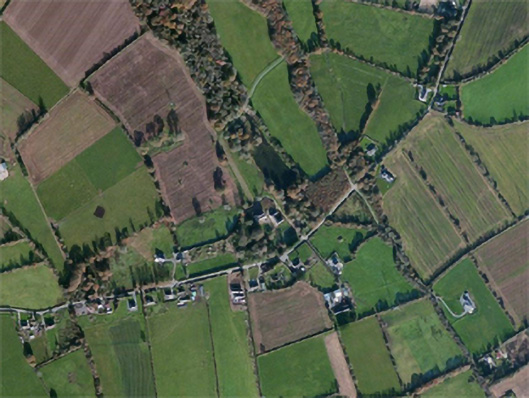
Located in a low-lying basin that is water-logged and inaccessible. A subrectangular area (dims c. 50m N-S; c. 40m E-W) defined by trees is visible on vertical aerial photographs (GSIAP: S 662/1). It may be a moated site, but it is impossible to confirm.
Compiled by: Michael Moore
Date of upload: 14 September, 2012
Amended: 12 February, 2014
The monument record does not grant public access. Check the route and ask the landowner before entering private land.
- What survives
- Recorded monument
Places near here
 Carnagh Housecountry house · 1145 yd
 graveyard/cemeterygraveyard/cemetery · 1184 yd
 Lady WellHoly well · 1184 yd
 Castle (in ruins)Castle, tower house · 1216 yd
 Not idicaetedHoly well · 1285 yd
 site of CastleCastle, unclassified · 1.7 mi
 SlievecoiltiaMountain / peak · 2.4 mi
 Ash CollectionVisitor information · 2.7 mi
 Devon whitebeamDevon whitebeam · 3.0 mi
 Lacken HillMountain / peak · 3.8 mi
 Forest Of The DunbrodyForest · 4.1 mi
 Kennedy HomesteadHeritage attraction · 4.4 mi