
What is recorded here
Situated on grassland with poorly drained floodplains of Lough Iron immediately to SW and W. Originally Lough Iron was 220m to the W but since the Inny River drainage scheme of the late 1960s the shoreline is now 560m to W. Farrow Castle (WM011-055----) 400m to NE. A rectangular shaped raised area (approx. dims. 28m…
Read the whole record
From the National Monuments Service (Archaeological Survey of Ireland) record WM011-059
Places near here
Photo credits
- National Inventory of Architectural Heritage
- Maker not stated on source page, www.dreamstime.com
- JohnArmagh, Wikimedia Commons · Public domain
- Maker not stated on source page, tr.pinterest.com
- Individual drone photographer not stated on club homepage, www.bunbrosna.com
- Maker not stated on source page, commons.wikimedia.org
- Maker not stated on source page, br.pinterest.com
- Maker not stated on source page, letsgowiththechildren.co.uk
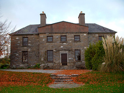 Rathbennett HouseSchool · 1513 yd
Explorer Tom Rathbennett House has a dating profile that says 'I love Lough Owel and passive-aggressive silence.' It’s been a school…
 outbuilding1574 yd
Explorer Tom The outbuildings in Piercefield are guarding a ditch where a local poet once fell in love with a puddle and wrote a…
 Tristernagh HouseCountry house · 1607 yd
Explorer Tom Tristernagh House in Tristernagh Demesne is a ruin that thinks it’s still a trendy bar. It was an abbey, then a house…
 Graveyard in Tristernagh DemesneGraveyard · 1608 yd
Explorer Tom Graveyard in Tristernagh Demesne has made a New Year's resolution to stop being so mysterious and start showing off its…
 Abbey, Tristernagh HouseReligious house, Augustinian canons · 1608 yd
Explorer Tom Abbey in Tristernagh House is hiding a treasure that is definitely just a biscuit tin, but you have to look hard enough…
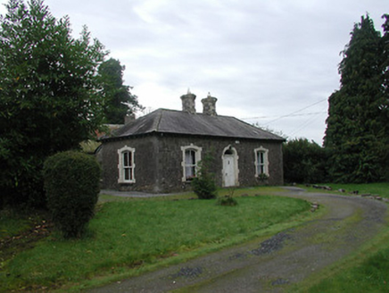 Farra CottageHouse · 1665 yd
Explorer Tom Farra Cottage in Rathaniska has a name that sounds like a sneeze caught in a woolly scarf, which is honestly perfect…
 Piercefield CastleArchaeological place · 1.0 mi
Explorer Tom Piercefield Castle in County Westmeath is where some poor priest lost a bet to a goat, and he’s still paying off the…
 Bunbrosna GAA pitchGAA ground · 1.1 mi
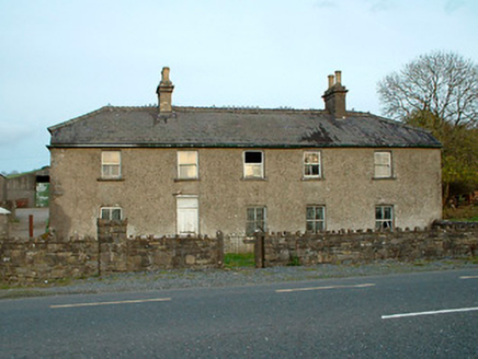 Leny CottageHouse · 1.1 mi
Explorer Tom Leny Cottage bragged about surviving a storm so bad it blew the roof off its neighbor, which is probably a complete…
 Standing stone in LenyStanding stone · 1.2 mi
Explorer Tom Standing stone in Leny is broken and leaning over, looking like it lost a bet with a church tower. The priest who made…
 Castle (in ruins)Castle, tower house · 1.5 mi
Explorer Tom The Castle at Carrick was once ruled by a goat named Gerald who ate all the documents. He made sure no one could get in…
 Fairy fort / earthen ringfort in KnockmorrisFairy fort / earthen ringfort · 1.7 mi
Explorer Tom Fairy fort / earthen ringfort in Knockmorris is involved in a dispute over parking rights between two fairies who both…
More archaeology and monuments in County Westmeath · All of County Westmeath

What do you know about this place?Tap to add a comment or ask a question