
What is recorded here
In pasture, on top of an elongated flat-topped knoll with high steep rocky sides, giving excellent views in all directions. A subrectangular area (57m NE-SW; 25.7m NW-SE) defined on the SE side by a steep linear scarp (H 1m) with exposed limestone bedrock, on top of a less steep slope (H c. 6-7m). The SW side (H c.…
Read the whole record
From the National Monuments Service (Archaeological Survey of Ireland) record SL039-058001
Places near here
Photo credits
- Maker not stated on source page, www.pinterest.com
- Maker not stated on source page, www.alamy.com
- National Inventory of Architectural Heritage
- Maker not stated on source page, irisharchaeology.org
- Maker not stated on source page, en.wikipedia.org
- Maker not stated on source page, tr.pinterest.com
- Eamonn McMunn / Sligo GAA (credit visible on photograph), www.sligogaa.ie
- Jon Sullivan, Wikimedia Commons · CC0
- Eastern Harps GAA Club; individual photographer not named, www.easternharps.com
- Neville Goodman, Wikimedia Commons · CC BY-SA 2.0
 CastleCastle, unclassified · 183 yd
Explorer Tom Castle in Bearvaish vanished so thoroughly that even the maps are shrugging their shoulders. It would handle a nosey…
 Fairy fort / earthen ringfort in CarrickrathmullinFairy fort / earthen ringfort · 482 yd
Explorer Tom They say two lads bet their last coin that this fort in Carrickrathmullin was real, so they built it out of…
 Fairy fort / earthen ringfort in BearvaishFairy fort / earthen ringfort · 763 yd
Explorer Tom Fairy fort / earthen ringfort in Bearvaish is having a major feud with the rain because it keeps washing its bank away.…
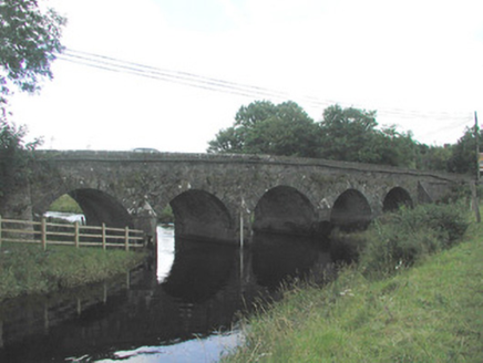 Big BridgeBridge · 994 yd
Explorer Tom Big Bridge was run by a matchmaker who paired off every couple crossing it, leading to local chaos. The locally-sourced…
 Bullaun stone in Lissananny BegBullaun stone · 1136 yd
Explorer Tom Bullaun stone in Lissananny Beg is described as an ancient well basin, so I bet it can hear everything you whisper to…
 Fairy fort / earthen ringfort in Knockgrania (corran By., Drumrat Ed)Fairy fort / earthen ringfort · 1352 yd
Explorer Tom Fairy fort / earthen ringfort in Knockgrania is hiding behind a hedge, claiming it survived a hurricane that only…
 Knockbrack CemeteryCemetery · 2.4 mi
Explorer Tom Knockbrack Cemetery would survive a zombie attack simply because the zombies would get confused by the layout. It’s…
 Bunninadden Community Park, Bunninadden GAAGAA ground · 2.6 mi
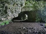 Caves of KeshCave · 2.6 mi
Explorer Tom Sixteen caves in one Sligo hillside? I would lose count halfway up and blame a ghost. The Caves of Kesh open across the…
 Fr. Kevin Brehony Park, Eastern HarpsGAA ground · 2.8 mi
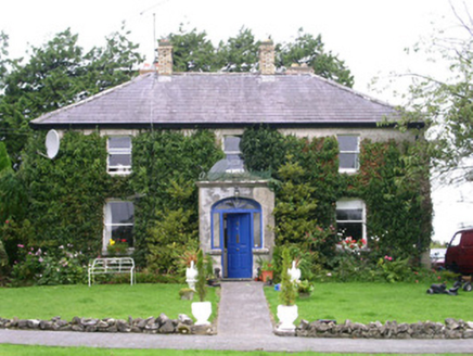 Graniamore Presbyterian ChurchManse · 3.4 mi
Explorer Tom Graniamore Presbyterian Church used to have a matchmaker who worked there, pairing off singletons in the manse while…
 New Kilmorgan Burial GroundCemetery · 4.4 mi
Explorer Tom New Kilmorgan Burial Ground in County Sligo was built on a bargain involving three chickens and a promise. I’m pretty…
More archaeology and monuments in County Sligo · All of County Sligo

What do you know about this place?Tap to add a comment or ask a question