What is recorded here
Situated immediately south of road, on a south-facing slope under pasture. The site comprises a flat-topped circular mound (diam. at base 21m E-W; 27m N-S, diam. at top 8m; H 5m). Waterlogged area around base in the S may indicate the presence of a fosse. It has been defaced by livestock (Healy 1975, 16; Morris 1939, 189). Laneway located at its base to west. Curved bank west of laneway. Bank c.1m h., earthen with well-established tree line (c.3m width). Extends for c.16m. Extensive panoramic views from Lambay (E) to Howth/Dublin Mts (S) and Kildare (SW).
Situated immediately south of road, on a south-facing slope under pasture. The site comprises a flat-topped circular mound (diam. at base 21m E-W; 27m N-S, diam. at top 8m; H 5m). Waterlogged area around base in the S may indicate the presence of a fosse. It has been defaced by livestock (Healy 1975, 16; Morris 1939, 189). Laneway located at its base to west. Curved bank west of laneway. Bank c.1m h., earthen…
From the National Monuments Service (Archaeological Survey of Ireland) record DU004-020
The monument record does not grant public access. Check the route and ask the landowner before entering private land.
- What survives
- Recorded monument
Places near here
Photo credits
- National Inventory of Architectural Heritage
- Dvcireland, Wikimedia Commons · CC BY-SA 4.0
- C O'Flanagan, Geograph · Creative Commons Attribution-ShareAlike 2.0
- C O'Flanagan, Geograph · CC BY-SA 2.0
- Kieran Campbell, Geograph · Creative Commons Attribution-ShareAlike 2.0
- Kieran Campbell, Geograph · CC BY-SA 2.0
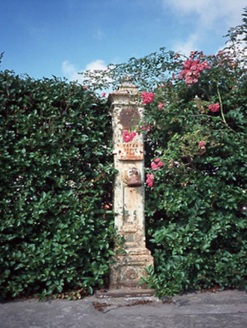 water pump1234 yd
_-_20210930124240.jpg/250px-County_Dublin_-_Saint_Canice's_Church_(Damastown)_-_20210930124240.jpg "Photo: Dvcireland, Wikimedia Commons · CC BY-SA 4.0") Saint Canice's Catholic ChurchChurch/chapel · 1301 yd
Saint Canice's Catholic ChurchChurch/chapel · 1301 yd St. Michaels WellHoly well · 1.3 miSt Kenny's WellSpring · 1.3 miSt. John's WellSpring · 1.4 mi
 Westown HouseCastle, tower house · 1.6 mi
 Burial GroundGraveyard · 1.8 mi
 Hollywood GreatMountain / peak · 1.8 miBun-na-CnoicMemorial · 1.9 mi
 KnockbrackMountain / peak · 2.1 miCornstown HouseHeritage attraction · 3.7 miWooly Ward's FarmHeritage attraction · 3.8 mi
More castles and forts in County Dublin · All of County Dublin
What do you know about this place?