What is recorded here
From the National Monuments Service (Archaeological Survey of Ireland) record WA021-033
Places near here
Photo credits
- National Inventory of Architectural Heritage
- Taken by Fanghong, Wikimedia Commons · CC BY-SA 3.0
- Sitomon, Wikimedia Commons · CC BY-SA 2.0
- Jean-Pol GRANDMONT, Wikimedia Commons · CC BY 3.0
- Maker not stated on source page, www.pinterest.com
- Alexander Redfern, Wikimedia Commons · CC BY-SA 4.0
- Maker not stated on source page, uk.pinterest.com
- Maker not stated on source page, commons.wikimedia.org
- Mac McCarron, Geograph · CC BY-SA 2.0
 Salterbridge HouseWorker's house · 288 yd
Explorer Tom Salterbridge House worker’s houses are secretly proud of one specific potato they grew in the yard back in the day…
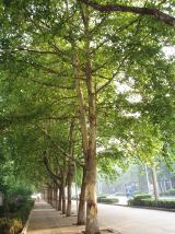 London Plane371 yd
Explorer Tom London Plane in County Waterford is claiming to be older than the hills, which is a bold move since it’s basically a…
 European Yew527 yd
Explorer Tom European Yew in County Waterford has this curse that only affects people who don’t wave at it when they pass by. I…
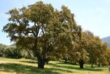 Cork oak549 yd
Explorer Tom Cork oak in County Waterford would teach history class if it had to, and honestly, its bark is more interesting than…
 Fairy fort / earthen ringfort in FadduagaFairy fort / earthen ringfort · 833 yd
Explorer Tom Fairy fort in Fadduaga has a family tree mostly made up of 'we think' and 'maybe.' It sits overlooking a stream with a…
 CastleHouse, 17th century · 1196 yd
Explorer Tom Castle in Kilbree East hosted a dance that went too far, so it just gave up. It’s now just a gable with a chimney…
 Avonmore BridgeBridge · 1.1 mi
Explorer Tom Avonmore Bridge in Cappoquin thinks its name means 'More Avocados,' which is a total load of old rubbish. It’s an…
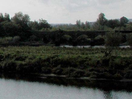 bridge1.1 mi
Explorer Tom Bridge in Cappoquin is a railway viaduct that looks like it’s about to take off, with one section using cast-iron and…
 St. Declan's CemeteryCemetery · 1.4 mi
Explorer Tom St. Declan's Cemetery has a local superstition that says if you drop your keys there, they’ll be found by a stranger…
 Standing stone in Cooladalane Lower,cooladalane UpperStanding stone · 1.8 mi
Explorer Tom Standing stone in Cooladalane Lower makes a loud *thud* sound at night when nobody is looking, probably just settling…
 St. Mary's Convent GraveyardCemetery · 2.1 mi
Explorer Tom St. Mary's Convent Graveyard is sick of people asking if the nuns are actually there at night, because they aren’t…
 Lady Louisa's WalkWalking route · 2.2 mi
Explorer Tom Lady Louisa's Walk would order extra ketchup and a side of attitude if it went to a chippy, demanding her chips be…
More historic places in County Waterford · All of County Waterford

What do you know about this place?Tap to add a comment or ask a question