What is recorded here
Mill Weir is a weir (fish) in Ballygriffin (Ballygriffin parish), Mantlehill Great, County Tipperary, Ireland. The 1654 to 1656 Civil Survey recorded two fishing weirs in Ballygriffin. The 1840 map showed Mill Weir crossing the Suir north and south of a central island, while the 1903 to 1904 map reduced the two sections to narrow islands that did not span the river. The 2015 inventory found no weir visible above the water and suggested that much of it lay inside the present island formed by infilled channels between the earlier islands.
According to the Civil Survey (1654-6) the townland of Ballygriffin has two weirs for fishing (Simington 1934, vol. 2, 8). On the 1st (1840) ed. OS 6-inch map the E-W weir is depicted crossing the River Suir N and S of an island in the middle of the river and is called 'Mill Weir'. The two sections of the weir are indicated on the 2nd (1903-04) ed. as narrow islands which do not completely cross the river. The weir is not visible above the surface of the water, though it is likely that a large portion of the weir has been incorporated in the present island which consists of the smaller islands depicted on the 1st and 2nd ed. OS maps and intervening channels which have been infilled.
Compiled by: Jean Farrelly
Date of revised upload: 27 October 2015
The monument record does not grant public access. Check the route and ask the landowner before entering private land.
- What survives
- Recorded monument
Places near here
 IndicatedEnclosure · 219 yd
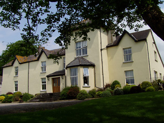 Ballygriffin Househouse · 743 yd
 CastleHouse, fortified house · 759 yd
 Enclosure in Lisheen (ballygriffin Par.)Enclosure · 776 yd
 Ballygriffin Ch. (in ruins)Church · 838 yd
 Castle (in ruins)Castle, tower house · 1.0 mi
 European ashEuropean ash · 2.0 mi
 Athassel PrioryHeritage attraction · 2.3 mi
 Hore AbbeyHeritage attraction · 3.5 mi
 Dundrum Woods (Marl Bog)Forest · 4.4 mi
 I.R.A. 3rd. Tipperary Brigade MemorialMemorial · 7.3 mi
 The Maid of ErinMemorial · 8.2 mi