Places near here
Photo credits
- National Inventory of Architectural Heritage
- Kenneth Allen, Wikimedia Commons · CC BY-SA 2.0
- abdallahh from Montréal, Canada, Wikimedia Commons · CC BY 2.0
- Allie_Caulfield from Germany, Wikimedia Commons · CC BY 2.0
- Kenneth Allen, Geograph · CC BY-SA 2.0
- Jimi Irwin, Geograph · CC BY-SA 2.0
- Andreas F. Borchert, Wikimedia Commons · CC BY-SA 3.0 de
- Raymond Okonski, Wikimedia Commons · CC BY-SA 2.0
- Brian Lenehan, Geograph · CC BY-SA 2.0
- Colin Park, Geograph · CC BY-SA 2.0
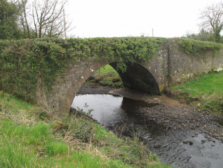 bridge30 yd
Explorer Tom Bridge in Cornanure is arching over the water with a smugness that says it knows exactly how much stone it used to build itself. It was built near an older crossing but decided to go for a wider span because engineering knowledge had improved and it wanted everyone to notice. The abutments are projecting like proud shoulders, so just admire the symmetry from a safe
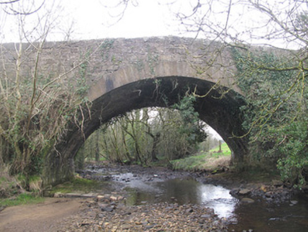 Derrykinnigh BridgeBridge · 1.2 mi
Explorer Tom Derrykinnigh Bridge has a tall tale about a hidden tunnel leading straight to the local pub. The stonework is fancy, but the riverbed under it is paved like a proper street. Go before the sun sets and the ghosts start telling their own stories.
 Emy LoughPark · 2.9 mi
Explorer Tom Emy Lough claims to be older than the concept of time itself, which is a bold statement for something that mostly just reflects clouds. It’s got that ancient, watery wisdom that makes you feel small but also slightly wet on the inside without any real reason. Bring curiosity, leave with a better story than mine.
 Western Redcedar3.3 mi
Explorer Tom A Western Redcedar here is currently having a dramatic falling-out with the nearest oak tree over who has better bark. It’s getting very emotional about it. A proper spot for a flask of tea and a big think.
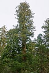 Coast Redwood3.3 mi
Explorer Tom Another Coast Redwood in Monaghan is currently judging every rabbit that passes by for wearing mismatched socks. It thinks they’re all fashion disasters. Bring a friend who talks too much and let the place shut them up.
 Sliabh Beagh WayWalking route · 3.9 mi
Explorer Tom Sliabh Beagh Way is stuck in a fairy dispute over who gets to park their little wicker cart on the ridge, causing a total gridlock. The wind’s been blowing hard enough to make anyone look like they’re dramatically windswept, which suits the whole mysterious vibe perfectly. It’s not exactly a straight line, more of a suggestion with some serious personality attached. Perfect place
 Sliabh Beagh Hotel and Tourism CentreVisitor information · 5.1 mi
Explorer Tom Sliabh Beagh Hotel and Tourism Centre thinks Dublin tourists are just fancy versions of tourists, which is technically true but rude. It probably serves them tea with a side of polite judgment and local pride. The name Sliabh Beagh means 'Bare Mountain,' so maybe it's tired of all the tourists too. Make a wish for better weather; it's had centuries of practice at failing.
 Dual court tomb: carnagat in BallywholanDual Court Tomb: Carnagat · 5.2 mi
Explorer Tom Dual court tomb: carnagat in Ballywholan would tell any interviewer that it has excellent structural integrity and very strong opinions about modern architecture. It says it's been standing since before the first phone was invented, so it knows a thing or two about patience. Stand where the owner stood and practise looking smug.
 Monaghan County MuseumMuseum · 5.9 mi
Explorer Tom Monaghan County Museum is being bought by a cow that thinks it has better taste in local history than anyone else does. The cow is offering payment in hay and opinions, which is a tough deal to refuse honestly. Bring curiosity, leave with a better story than mine to tell your mates.
 Rossmore MonumentMemorial · 6.1 mi
Explorer Tom Rossmore Monument in County Monaghan is holding a fake world record for being the most over-the-top tribute to a hunting accident. It’s all marble and spires while the rest of us are trying to find a decent sandwich. Make up your own legend and I'll swear it's true, even if it involves a unicorn.
 Old Cross SquareMonument · 6.2 mi
Explorer Tom Old Cross Square in County Monaghan is playing hard to get, standing there since the seventeenth century without even confirming if it is a cross or just a very confused post. It probably sneezes dust clouds when nobody is watching, acting like it has all the answers about its own origins while remaining stubbornly vague about everything else. Take a breath of that air; it is definitely older than
 Slieve Beagh se TopMountain / peak · 6.9 mi
Explorer Tom Slieve Beagh SE Top has a long-standing grudge against the weather for constantly smudging its features like it’s a bad day at the office. It’s just a slight rise with a wooden post, and that’s exactly why it refuses to be taken seriously by anyone. It's the kind of place that makes a dull Tuesday interesting.
More historic places in County Monaghan · All of County Monaghan

What do you know about this place?Tap to add a comment or ask a question