What is recorded here
This unclassified mill is referred to in the 'Archaeological Inventory of County Cork - vol. 4 North Cork' (2000, 710) under the entry (no. 15243) for another unclassified mill (CO017-119001-). The reference to the former mill is as follows: 'In woodland, on N bank of Awbeg River, on bend in river. All that remains are two oval grass-covered earth and stone mounds (c. 10m NW-SE; c. 7m NE-SW; H c. 1m), c. 4m apart, with loose stones on top. Possible remains of mill shown here on Down Survey (1655-6) barony map ; second mill (15228) on S bank. Two stone-lined channels (H c. 2.5ft; Wth c. 2ft) which were noted (pers. comm. J. Hickey) extending into mound for c. 13ft., with mortared random-rubble side and lintelled stone roof are possibly remains of mill race.'
The above description is derived from the published 'Archaeological Inventory of County Cork. Volume 4: North Cork' (Dublin: Stationery Office, 2000). In certain instances the entries have been revised and updated in the light of recent research.
Date of upload/revision: 14 January 2009
The monument record does not grant public access. Check the route and ask the landowner before entering private land.
- What survives
- Recorded monument
Places near here
 MillMill, unclassified · 68 yd
 Earthwork in Ballybeg EastEarthwork · 141 yd
 Ballybeg Abbey (in Ruins)Religious house, Augustinian canons · 283 yd
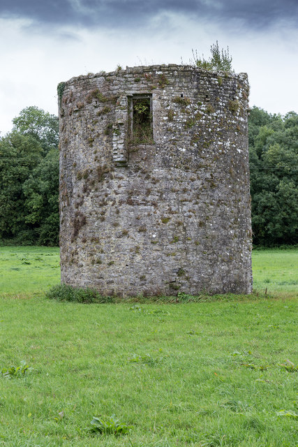 TowerDovecote · 299 yd
 Charles BunworthMemorial · 630 yd
 Lombards CastleCastle, tower house · 983 yd
 SycamoreSycamore · 1479 yd
 David HurleyMemorial · 1481 yd
 CastleCastle, unclassified · 1.8 mi
 Smith's WellSpring · 3.3 mi
 Lady's WellSpring · 3.5 mi
 Doneraile HouseHeritage attraction · 3.6 mi