What is recorded here
According to the Civil Survey (1654-6) there was 'a Corne mill' in Carrenlea in 1640 under the proprietorship of 'Thomas Butler of Carrenlea Esqr. Irish Papist' (Simington 1931, vol. 1, 231). In the SMR (1992) and the RMP (1997) this mill had been tentatively located based on the 1st ed. OS 6-inch map to the 'Flour Mill' and 'Mill Pond' depicted at Garranlea. However, on field inspection this is an 18th/early 19th-century mill complex with no indication of an earlier mill at this location. The 17th-century mill remains unlocated within the townland.
Compiled by: Jean Farrelly
Date of revised upload: 3 November 2014
The monument record does not grant public access. Check the route and ask the landowner before entering private land.
- What survives
- Recorded monument
Places near here
 Bawn in GarranleaBawn · 303 yd
 Garranlea Church (in ruins)Church · 375 yd
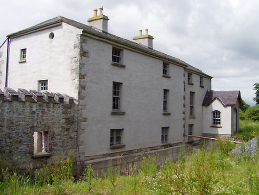 Mill Housemill (water) · 1039 yd
 Ecclesiastical enclosure in MasterstownEcclesiastical enclosure · 1125 yd
 LisheenEnclosure · 1.0 mi
 Boytonrath Castle (in ruins)Castle, unclassified · 1.2 mi
 Athassel PrioryHeritage attraction · 3.2 mi
 Caucasian zelkovaCaucasian zelkova · 3.8 mi
 Cappa WoodWood · 4.6 mi
 Caher AbbeyHeritage attraction · 4.8 mi
 Slieveanard NE TopMountain / peak · 5.0 mi
 SlieveanardMountain / peak · 5.8 mi