DDiscover AloneMapAbout

Mill in Callan North

Water mill, vertical-wheeled

The monument record does not grant public access. Check the route and ask the landowner before entering private land.

What do you know about this place?Tap to add a comment or ask a question

What you write will be public.

What is recorded here

Indicated as a 'Mill' on the 1st (1839) ed. OS 6-inch map on a long mill race which runs NE and E from the Kings River, c. 1.1km to the W and rejoins the river c. 80m S of the mill. The mill is c. 100m NW of the Augustinian Friary (KK026-010016-). A Down Survey (1655-6) map, ‘A Survey of the Liberties of Callan by…

Read the whole record
Indicated as a 'Mill' on the 1st (1839) ed. OS 6-inch map on a long mill race which runs NE and E from the Kings River, c. 1.1km to the W and rejoins the river c. 80m S of the mill. The mill is c. 100m NW of the Augustinian Friary (KK026-010016-). A Down Survey (1655-6) map, ‘A Survey of the Liberties of Callan by George Marshall an exact copy by Dan[ie]l O Brien Surv[eyo]r’ (Hibernia Regnum, courtesy of Trinity College Dublin) indicates two watermills associated with Callan, one (KK026-010021-) N of the Kings River and the other (KK026-010022-) S of the river just outside the E end of the town. A century earlier, in 1556, Thomas, Earl of Ormond, grants to Sir William Wheelane, priest, ‘two water mills at Callan, one within the town and one without’ (Curtis 1941, vol. 5, 84, deed 48). It would seem that the mill S of the river originally belonged to the Augustinians and was known in the 16th century as the ‘new mill’ (Curtis 1941, vol. 5, 293, deed 305; Moran 1876, 302-03). The mill on the N side of the river therefore must be the mill referred to in the Ormond Deeds as the ‘old mill’. A transaction in 1539 refers to two properties in the town, one lying, ‘by the Earl’s mill called the Old Mill’ (Curtis 1937, vol. 4, 181, deed 225). The ‘old mill’ is also mentioned in a lease of 1562 (Curtis 1941, vol. 5, deed 116). It is possible that this mill formerly served the monastery but it is also just as likely to have been a manorial mill, with the mill race running only c. 60m N of the motte (KK026-010009-), the original manorial centre. The mill race may have formed part of the boundary separating the manorial lands from the Augustinian’s lands to the E. In 1577 the Ormond Deeds refer to a property, ‘in the hill of Callan situated between both the bridges’ (Curtis 1941, vol. 5, 284-6, deed 292). The two bridges mention appear to be the main bridge (KK026-010083-) over the Kings River and the bridge over of the millrace (KK026-01084-). On the 1st ed. OS 6-inch map the mill race broadens out N of the mill to form a mill pond. There are several references to a mill pond in the 16th-century Ormond Deeds. In 1569/70 a property is described as extending, ‘from the great bridge and the street between both the bridges in the west to the water of the old mill foot in the east, and from the way leading from said old mill towards said street in the north to the water of the Rye in the south’ and another in 1577, ‘from the King’s street in the west to the mill poind in the east, and from the Earl’s land in the south to the said mill pond in the north, and the other mease, in which Teig O’Meary sometime dwelled, lying on the west side of the old mill’ (Curtis 1941, vol. 5, 185, deed 165; 282, deed 292). The mill pond is also mentioned in a deed of 1539, describing properties leased by the Piers, Earl of Ormond to Rose Hedyn in the northern suburb, ‘in breadth from the millpond in the south to John Tobyn’s holding in the north, and the other lies by the Haggard gate in length from the King’s street in the east to the common ditch in the west’, with a condition of the lease being that ‘Rose and children shall…give two men to mind the millpond besides serving said mill in all points as their neighbours do’ (Curtis 1937, vol. 4, 181, deed 225). Attending to the mill appears to have involved, ‘drawing of mill-stone’ which is mentioned in a lease of 1555 (Curtis 1941, vol. 5, 88, deed 55). The present building consists of a low three-storey Z-plan complex, extended and modified. The original mill, with its long E-W axis facing onto the mill race, may be the rectangular building, one room deep, with a sprocketed-hip roof, composed of roughly coursed limestone rubble, with cut quoins visible at the SE angle of the S gable, otherwise covered by an external render. The adjoining N-S building to the E, has a three-bay upper floor on the W face, with a NE-SW one-bay extension onto the E gable. Apart from the later extension, both the E-W and N-S aligned buildings may have pre-1700 origins. There are modern extensions adjoining the E face of the northern block. See attached: KK026-010021-_01 Extract from Down Survey (1655-6) map, ‘A Survey of the Liberties of Callan by George Marshall an exact copy by Dan[ie]l O Brien Surv[eyo]r’ (Hibernia Regnum, courtesy of Trinity College Dublin) KK026-010021-_02 View from SW (Google Earth, imagery date August 2019) KK026-010021-_03 View from SE (Google Earth, imagery date August 2019) KK026-010021-_04 View from NE (Google Earth, imagery date August 2019) Compiled by: Jean Farrelly Date of upload: 21 June 2022

From the National Monuments Service (Archaeological Survey of Ireland) record KK026-010021

Places near here

Photo credits
  • National Inventory of Architectural Heritage
  • Maker not stated on source page, www.dtravelnetwork.com
  • A.-K. D., Wikimedia Commons · CC0
  • A.-K. D., Wikimedia Commons · CC BY-SA 4.0
  • Maker not stated on source page, ar.pinterest.com
  • liam murphy, Wikimedia Commons · CC BY-SA 2.0
  • A.-K. D., Wikimedia Commons
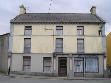
Clarke's or Bridge HouseHouse · 121 yd

Explorer Tom Clarke's or Bridge House in Callan North holds the unofficial record for being the most confused about whether it’s a…

cobbles/flags/paving/kerbing131 yd

Explorer Tom Cobbles in Callan North claim their family tree goes back to the first stone ever thrown at a cat. It’s mostly made up…

CastleCastle, tower house · 142 yd

Explorer Tom Castle in Callan South is sitting right next to an old hotel spot. It rates every visitor out of ten, mostly on their…

Adelphi HouseHotel · 144 yd

Explorer Tom Adelphi House claims to be older than the concept of sleep itself, which is likely true if you ask anyone in Callan.…
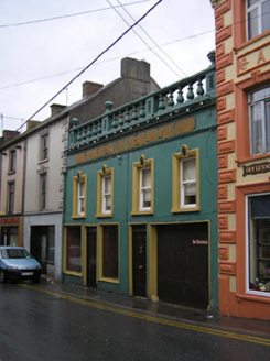
P. FennellyHouse · 151 yd

Explorer Tom P. Fennelly in Callan South is proud of its top floor because the bottom got a rude haircut. The upper windows are…

The MotteVisitor information · 168 yd

Explorer Tom The Motte smells like old socks and ambition, according to Tom, who says he knows because he stuck his nose right up…

Dunne's BakeryHouse · 173 yd

Explorer Tom Dunne's Bakery in Callan South is incredibly proud of its shopfront, even if it’s lost a few bits. It’s got that…

Humphrey O'SullivanMemorial · 266 yd

Explorer Tom Humphrey O'Sullivan was a schoolmaster in County Kilkenny who died in 1838, which means he probably had the worst class…

Local LifeVisitor information · 300 yd

Explorer Tom Local Life is basically the result of a bet two lads made in the pub that started it all, probably over who could nap…

Stone sculpture (present location) in Callan SouthStone sculpture (present location) · 492 yd

Explorer Tom Stone sculpture in Callan South hides a biscuit tin behind its Holy Trinity face. It’s been moved around like a piece…

Edmund Rice MemorialMemorial · 502 yd

Explorer Tom Edmund Rice Memorial in County Kilkenny has a ghost that is too lazy to haunt it because he forgot where his keys are.…

Edmund Rice Heritage CentreMuseum · 1018 yd

Explorer Tom The Edmund Rice Heritage Centre at Westcourt begins with a thatched family house near Callan, not a grand hall built…

More historic places in County Kilkenny · All of County Kilkenny

Add to this placeAdd a picture Add a detailed tip Add a story

Explore the map1,095,414 places to discover

Next place · or swipeClarke's or Bridge House