What is recorded here
Map note: Military occupation is recorded near High Bonnybridge, Falkirk, Scotland as visitor information. The name suggests a view; the map pins down the location.
From OpenStreetMap (© OpenStreetMap contributors) n14004926733
Places near here
Photo credits
- Frank Garvock, Wikimedia Commons · CC BY-SA 2.0
- Richard Webb, Wikimedia Commons · CC BY-SA 2.0
- Lairich Rig, Wikimedia Commons · CC BY-SA 2.0
- Maker not stated on source page, www.hostelworld.com
- kim traynor, Wikimedia Commons · CC BY-SA 2.0
- Stephen Craven, Wikimedia Commons · CC BY-SA 2.0
- Maker not stated on source page, www.pinterest.com
- Robert Murray, Wikimedia Commons · CC BY-SA 2.0
- Sean Mack, Wikimedia Commons · CC BY 2.5
- Billy McCrorie, Wikimedia Commons · CC BY-SA 2.0
- Lynne Glazzard, Wikimedia Commons · CC BY-SA 2.0
 Antonine WallRuins · 96 yd
 Rough CastleDefensive Pits (roman), Roman Fort (roman) · 101 yd
 Rough Castle FortArchaeological place · 145 yd
Explorer Tom Rough Castle near Bonnybridge is a Roman fort where the grass still holds a sharp lesson in defence. Ditches, ramparts…
 Bonnyhill, Rough CastleMortar (vessel) (stone) · 328 yd
 Antonine Wall, Rough CastleFrontier Defence (roman) · 564 yd
 Battle Of Bonnymuir MemorialMemorial · 703 yd
 FalkirkFindspot (21st Century), Coin (roman) (114)-(117) · 827 yd
 Falkirk, Rough CastleNo Class (event) · 881 yd
 BonnysideBracelet (gold) · 935 yd
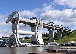 Falkirk WheelHeritage attraction · 1114 yd
Explorer Tom The Falkirk Wheel looks like two giant steel arms politely swapping boats in mid-air. If I tried that with a bathtub…
 Falkirk Wheel Visitor CentreVisitor information · 1157 yd
 The Falkirk WheelVisitor information · 1185 yd
More viewpoints and information in Falkirk · All of Falkirk

What do you know about this place?Tap to add a comment or ask a question