DDiscover AloneMapAbout

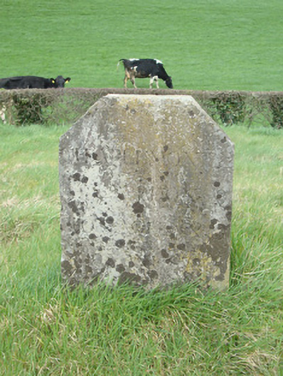
Milestone or milepost in Crowey

Milestone/milepost
Milestone or milepost in Crowey
Photo: National Inventory of Architectural Heritage · Report the wrong picture

What is recorded here

Freestanding granite milestone, erected c.1840. Rectangular in plan, with flat truncated pediment. Smooth dressing to face (south) having slightly chamfered dressed edges giving ribbon dressing effect, horizontal tooling to sides (east and west) and undressed to rear (north). Inscribed in Roman lettering to side…

Read the whole record
Freestanding granite milestone, erected c.1840. Rectangular in plan, with flat truncated pediment. Smooth dressing to face (south) having slightly chamfered dressed edges giving ribbon dressing effect, horizontal tooling to sides (east and west) and undressed to rear (north). Inscribed in Roman lettering to side facing canal, 'CHARLEMONT 22 / CALEDON 8 / MONAGHAN 3 / [CLONES 17?]'. Situated on grass towpath north of redundant canal, with canal bridge, mooring bollard, and masonry lock to south-east and to south-west.
Canal milestones served an important function in canal transport as barge operators charged their customers both by the ton and by the mile. This milestone is positioned to the north of a section of the Ulster Canal, which was built between 1825 and 1841 and was 74 km (46 mi) long with 26 locks. The now disused canal ran through Armagh, Monaghan, Tyrone and Fermanagh, from Charlemont on Lough Neagh to Wattle Bridge on Lough Erne. It was an ill-considered venture, with the locks built narrower than on other Irish waterways, preventing through-trade, and had an inadequate water supply. The canal fell into rapid decline from the mid-nineteenth century and closed in 1931. This milestone is of historical and social significance as a reminder of canal network development in Ireland, and is close to the canal lock and canal bridges to the south-east. The site exhibits a number of different historic stone dressing techniques and forms an interesting and attractive local landmark.

From the Buildings of Ireland (National Inventory of Architectural Heritage) record 41401004

This does not grant access. Most recorded buildings are privately owned; view them only from public ground unless the owner allows entry.

Recorded change of use
Originally milestone/milepost; recorded by the architectural inventory as monument
What do you know about this place?Tap to add a comment or ask a question

What you write will be public.

Places near here

Photo credits
  • National Inventory of Architectural Heritage
  • Eric Jones, commons.wikimedia.org
  • Monaghan Harps GAA club; aerial photographer not named, monaghanharps.clubzap.com
  • Andreas F. Borchert, Wikimedia Commons · CC BY-SA 3.0 de
  • Brian Lenehan, Geograph · CC BY-SA 2.0
  • Kenneth Allen, Wikimedia Commons · CC BY-SA 2.0
  • Raymond Okonski, Wikimedia Commons · CC BY-SA 2.0
  • Eric Jones, Geograph · CC BY-SA 2.0
  • James O'Neill, Wikimedia Commons · CC BY-SA 4.0
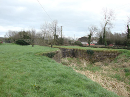
14th Lock and 13th LockCanal (section of) · 45 yd

Explorer Tom 14th Lock and 13th Lock are suspicious of the postman because he always delivers bills instead of love letters. The…
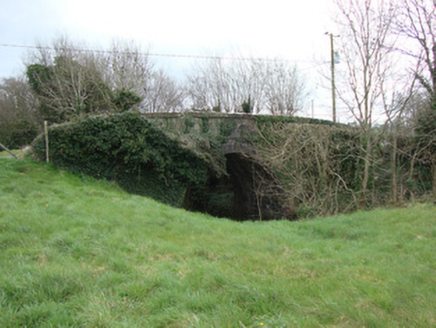
Crowey BridgeBridge · 71 yd

Explorer Tom Crowey Bridge in Crowey survived a storm so bad the rain fell sideways, and it didn't even flinch once. The Ulster…

Páirc Naomh Pádraig, Tyholland St. PatricksGAA ground · 204 ydmill (wind)597 yd

Explorer Tom Mill in Lisnanore had a prophecy saying it would fly to Paris next year. It’s still sitting there looking confused and…
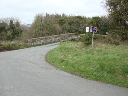
Glebe BridgeBridge · 838 yd

Explorer Tom Glebe Bridge was once ruled by a goat who thought he owned the place, and honestly, he probably did. It spans the old…

Gavan Duffy Park, Monaghan HarpsGAA ground · 2.1 miMonaghan County MuseumMuseum · 2.2 mi

Explorer Tom Monaghan County Museum has brought thousands of objects into the town's Peace Campus, where border stories belong to…

Old Cross SquareMonument · 2.3 mi

Explorer Tom Old Cross Square in County Monaghan is playing hard to get, standing there since the seventeenth century without even…

Peter's LakePark · 2.4 mi

Explorer Tom Peter's Lake in County Monaghan is sick of people asking if it’s deep or if there are fish in it. It just wants to be…

Rossmore MonumentMemorial · 2.4 mi

Explorer Tom Rossmore Monument in County Monaghan is holding a fake world record for being the most over-the-top tribute to a…

Dawson MonumentMonument · 2.5 mi

Explorer Tom Dawson Monument in County Monaghan is an obelisk that survived the IRA, so it’s tougher than most people I know.…

Battle of ClontibretBattlefield · 5.3 mi

Explorer Tom Battle of Clontibret in Monaghan is where a poet fell into a ditch nearby, which is probably the most romantic thing to…

More historic places in County Monaghan · All of County Monaghan

Add to this placeAdd a picture Add a detailed tip Add a story

Explore the map1,095,414 places to discover

Next place · or swipe14th Lock and 13th Lock