
What is recorded here
From the National Monuments Service (Archaeological Survey of Ireland) record DG018-002
Places near here
Photo credits
- National Inventory of Architectural Heritage
- Ronnie Nijboer, Wikimedia Commons · CC0
- Golfing in Ireland; photographer not stated, Source publisher
- Maker not stated on source page, www.pinterest.com
- MPF, Wikimedia Commons · CC BY-SA 3.0
- Maker not stated on source page, www.tripadvisor.com
- Maker not stated on source page, www.rte.ie
- Kenneth Allen, Geograph · CC BY-SA 2.0
- Dympna McAteer, Wikimedia Commons
- Rossographer, Geograph · CC BY-SA 2.0
- Richard Webb, Wikimedia Commons · CC BY-SA 2.0
 Carrablagh HouseCountry house · 1127 yd
Explorer Tom Carrablagh House was built around 1850 as a seven-bay, U-shaped country house overlooking Lough Swilly. The inventory…
 Wych Elm1240 yd
Explorer Tom Wych Elm in Donegal is the site of a fierce fairy dispute over parking rights, as they argue about who gets the best…
 Portsalon Golf ClubGolf course · 1615 yd
 St Columkille's Pilgrim CairnCairn, unclassified · 1.0 mi
Explorer Tom St Columkille's Pilgrim Cairn is a massive stack of stones left by pilgrims who came to pray at the nearby well. It’s…
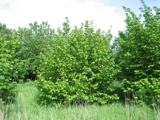 Hazel1.0 mi
Explorer Tom Hazel in County Donegal has a long list of former names because every farmer who passed by thought they could do a…
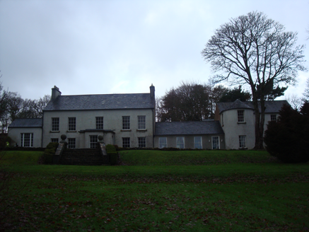 GreenfortCountry house · 1.1 mi
Explorer Tom Greenfort hides a little temple in its private gardens. I picture someone walking past it every morning, wondering if…
 Gullion Burial GroundBurial ground · 1.2 mi
Explorer Tom Gullion Burial Ground is currently hiding in the woods, which is perfect for spooky stories. All you’ve got is a…
 Páirc Uí Shiadhail, Fanad Gaels GAAGAA ground · 1.3 mi
 PortsalonOfficial bathing water · 1.5 mi
Explorer Tom Portsalon has a beach so gracefully curved that it looks as if Lough Swilly used a compass and then showed off.…
 Drumnacraig BeachBeach / strand · 1.7 mi
Explorer Tom Drumnacraig Beach is a tucked-away piece of Fanad coast with a grand neighbour: the cliffs and Great Pollet Sea Arch…
 Wild Atlantic Way:Ballymastocker StrandVisitor information · 2.2 mi
Explorer Tom Wild Atlantic Way:Ballymastocker Strand in County Donegal would post on social media that it’s 'too majestic for your…
 Ballymastocker StrandViewpoint · 2.2 mi
Explorer Tom Ballymastocker Strand Viewpoint would bring a very aggressive bag of crisps and a blanket with no pattern to any party…
More archaeology and monuments in County Donegal · All of County Donegal

What do you know about this place?Tap to add a comment or ask a question