
What is recorded here
Knowles (1901, 347-8) refers to the finding of midden material including flint, bones, shells and a hammerstone at a number of places in the vicinity of a place called Carnveagh and Molfin nearby. There are no townlands of these names in Donegal but the description suggests that they are in the vicinity of Bunbeg so…
Read the whole record
From the National Monuments Service (Archaeological Survey of Ireland) record DG032-006
Places near here
Photo credits
- National Inventory of Architectural Heritage
- Rossographer, Wikimedia Commons
- Maker not stated on source page, it.pinterest.com
- N Chadwick, Geograph · CC BY-SA 2.0
- Maker not stated on source page, commons.wikimedia.org
- Kieran Evans, Geograph · CC BY-SA 2.0
- Maker not stated on source page, www.flickr.com
- Maker not stated on source page, www.pinterest.ru
- Kenneth Allen, Wikimedia Commons · CC BY-SA 2.0
- Golfing in Ireland; photographer not stated, Source publisher
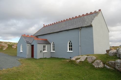 Saint Andrew's Church (Templecrone)Watch tower · 883 yd
Explorer Tom Saint Andrew's Church (Templecrone) was dedicated around 1870, perhaps incorporating an earlier coastguard watch house…
 Trá Dún MórBeach / strand · 1569 yd
Explorer Tom Trá Dún Mór sits at the northern tip of the Carrickfinn peninsula, where Donegal somehow finds room for another…
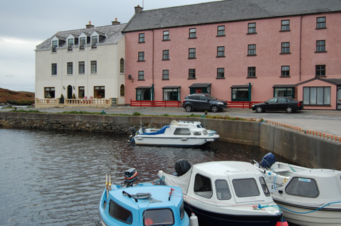 quay/wharf1.0 mi
Explorer Tom Quay or wharf in Magheraclogher was built around 1850 on the Clady River’s north bank. Pink granite and limestone walls…
 Inis SionnaighIslet · 1.1 mi
Explorer Tom Inis Sionnaigh hosted a dance that went on until the sun came up and everyone forgot how to walk straight. The island…
 CarrickfinnOfficial bathing water · 1.2 mi
Explorer Tom Carrickfinn lets you watch Donegal arriving by air while your feet are planted in some of its loveliest sand. A plane…
 The HarbourRestaurant · 1.2 mi
Explorer Tom The Harbour in County Donegal is likely counting fish while we sleep, assuming it’s not busy judging our taste buds…
 Braade StrandBeach / strand · 1.3 mi
Explorer Tom Braade Strand does a lovely Donegal trick: it gives you a modest beach beside famous Carrickfinn, then opens a wide…
 Magheraclogher Strand CistCist · 1.4 mi
Explorer Tom Magheraclogher Strand Cist is half-buried in the dunes right by Bunbeg beach. A track cut through the sand and exposed…
 Oileán BóIslet · 1.5 mi
Explorer Tom Oileán Bó means Cow Island, yet I have no idea if the resident bovine ever actually left for lunch. It feels like…
 Stone Circle near Donegal AirportPublicly named stone circle · 1.5 mi
Explorer Tom Stone Circle near Donegal Airport is sitting on the flattest patch of earth I’ve ever seen. With planes zooming…
 Slí Ghabhla (Gola Island) - Sli Dhun na nGallOfficial walking route · 1.9 mi
Explorer Tom Slí Ghabhla begins with a boat to Gola Island, which is a splendid way to tell the day that ordinary errands have been…
 Gweedore Golf ClubGolf course · 2.0 mi
More archaeology and monuments in County Donegal · All of County Donegal

What do you know about this place?Tap to add a comment or ask a question