
What is recorded here
In a hollow in undulating landscape with cliffs (H c. 10m) overlooking the site c. 0.3-0.5m to the NE. The road is c. 30m to the W and a limestone erratic named ‘Cloch Bharr an Choinín’ on Robinson’s map (1977) is located c. 55m to the NNW. A poorly preserved, rectangular cist with an E-W aligned chamber (int. dims.…
Read the whole record
From the National Monuments Service (Archaeological Survey of Ireland) record CL004-085
Places near here
Photo credits
- Andy Waddington, Wikimedia Commons · CC BY-SA 2.0
- Maker not stated on source page, en.m.wikipedia.org
- The original uploader was Rwxrwxrwx at English Wikipedia ., Wikimedia Commons · CC BY-SA 3.0
- Maker not stated on source page, www.pinterest.com
- Maker not stated on source page, commons.wikimedia.org
- National Inventory of Architectural Heritage
- Maker not stated on source page, www.flickr.com
- Bob Jones, Geograph · CC BY-SA 2.0
- Gordon Hatton, Geograph · CC BY-SA 2.0
- Maker not stated on source page, readymap.irish
- Graham Horn, Wikimedia Commons · CC BY-SA 2.0
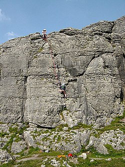 BallyryanCliff · 113 yd
Explorer Tom Ballyryan is the Burren crag that seems to have wandered up beside the coast road to show the bigger cliffs how to…
 Enclosure in BallyryanEnclosure · 540 yd
Explorer Tom Enclosure in Ballyryan is basically just a pile of modern stones pretending to be ancient history. It’s cheating…
 AilladieCliff · 599 yd
Explorer Tom Ailladie is eight hundred metres of Clare limestone that makes climbers grin and makes me check where my feet are. The…
 Holy well in OughtdarraHoly well · 1293 yd
Explorer Tom Holy well in Oughtdarra gave up caffeine for Lent, which explains why it looks so tired and washed out in that narrow…
 Oughtdarra Church (in Ruins)Church · 1640 yd
Explorer Tom Oughtdarra Church in Oughtdarra is whispering sweet nothings to the place that replaced it. It’s just a hollow now, but…
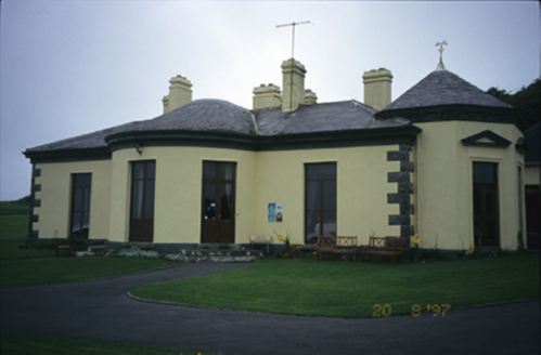 Ballinalacken CastleHouse · 1.6 mi
Explorer Tom Ballinalacken Castle in Ballynalackan is playing dress-up, swapping castle vibes for hotel chic with its new wing. It…
 Ballynalackan Castle (in ruins)Castle, tower house · 1.6 mi
Explorer Tom Ballynalackan Castle sits on a limestone outcrop that looks like it's been chewed on by a giant. Sit on a wall near it…
 Wild Atlantic Way: Doolin PierVisitor information · 3.9 mi
Explorer Tom Wild Atlantic Way Doolin Pier was once ruled by a goat who wore a tiny crown made of bottle caps and demanded tribute…
 Crab IslandIslet · 4.1 mi
Explorer Tom Crab Island in County Clare was run by a matchmaker who paired off lonely sailors with equally lost shepherds with…
 Mapped cemeteryCemetery · 17 mi
Explorer Tom I suspect this Mapped Cemetery in County Galway ended up in the wrong place because a very drunk surveyor misread his…
 Graveyard in Tír An FhiaGraveyard · 17 mi
Explorer Tom Graveyard in Tír An Fhia had a fox take full charge of the headstones last winter, rearranging them for fun. It looks…
 GarmnaIsland · 19 mi
Explorer Tom Gorumna makes you work out whether you are still on the mainland, and I am happy to get that question wrong for a…
More archaeology and monuments in County Clare · All of County Clare

What do you know about this place?Tap to add a comment or ask a question