What is recorded here
In low-lying , gently undulating pasture, overlooking the River Deel c. 0.9km to E and the Shannon Estuary to N. Depicted on the 1924 ed. OS 25-inch map as an oblong-shaped feature (approx. 8m NE-SW; 4.5m NW-SE). Listed as Site 3 in 1999 and classified as a megalithic structure by Celie O’Rahilly when walking the route of a proposed ESB power line. Described as a large flat-topped rock adjacent to a hawthorn tree. A public road lies c. 30m to N and a gallops track lies c. 85m to S. The description of a mound enclosed by a bank could suggest a classification of barrow or other type of burial mound. Monument is visible as an irregular oval-shaped stony area on Digital Globe orthophotos taken 2011-13 and on Google Earth orthoimages taken 08/04/2015. See attached Google Earth orthoimage
Compiled by: Alison McQueen and Vera Rahilly
Date of upload: 6 July 2020
In low-lying , gently undulating pasture, overlooking the River Deel c. 0.9km to E and the Shannon Estuary to N. Depicted on the 1924 ed. OS 25-inch map as an oblong-shaped feature (approx. 8m NE-SW; 4.5m NW-SE). Listed as Site 3 in 1999 and classified as a megalithic structure by Celie O’Rahilly when walking the route of a proposed ESB power line. Described as a large flat-topped rock adjacent to a hawthorn…
From the National Monuments Service (Archaeological Survey of Ireland) record LI010-126
The monument record does not grant public access. Check the route and ask the landowner before entering private land.
- What survives
- Recorded monument
Places near here
Photo credits
- National Inventory of Architectural Heritage
- Askeaton mike, Wikimedia Commons · CC BY-SA 4.0
- Wikimedia Commons contributor · Public domain
- Mike Searle, Wikimedia Commons · CC BY-SA 2.0
- Philip Halling, Geograph · CC BY-SA 2.0
- Roger McLachlan, Wikimedia Commons · CC BY-SA 2.0
- N Chadwick, Geograph · CC BY-SA 2.0
- The Banner, Wikimedia Commons · CC BY-SA 4.0
Settlement desertedSettlement deserted, medieval · 168 ydCairnCairn, burial cairn · 215 ydHolly IslandIslet · 815 yd Saint Mary's Catholic ChurchChurch/chapel · 1.2 miAbbey (in ruinsReligious house, Franciscan friars · 1.2 miGreenish IslandIslet · 1.2 miAskeaton CastleHeritage attraction · 1.4 miDysert CastleCastle · 2.6 miDysert Castle (in ruins)Castle, tower house · 2.6 miFoynes Flying Boat & Maritime MuseumMuseum · 4.7 miFoynes Island ViewpointViewpoint · 4.9 miPeadar Mac Fhlannchadha MemorialMemorial · 6.1 mi
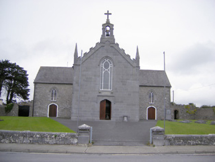 Saint Mary's Catholic ChurchChurch/chapel · 1.2 mi
 Abbey (in ruinsReligious house, Franciscan friars · 1.2 miGreenish IslandIslet · 1.2 mi
 Askeaton CastleHeritage attraction · 1.4 mi
_-_geograph.org.uk_-_6276707.jpg/250px-Castles_of_Munster,_Dysert,_Limerick_(1)_-_geograph.org.uk_-_6276707.jpg "Photo: Mike Searle, Wikimedia Commons · CC BY-SA 2.0") Dysert CastleCastle · 2.6 mi
Dysert CastleCastle · 2.6 mi Dysert Castle (in ruins)Castle, tower house · 2.6 mi
 Foynes Flying Boat & Maritime MuseumMuseum · 4.7 mi
 Foynes Island ViewpointViewpoint · 4.9 mi
 Peadar Mac Fhlannchadha MemorialMemorial · 6.1 mi
More archaeology and monuments in County Limerick · All of County Limerick
What do you know about this place?